
Enlarge image
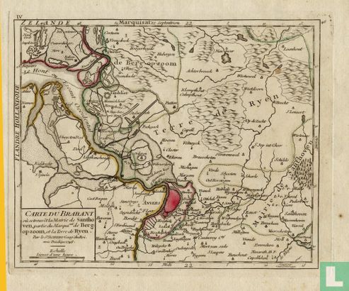
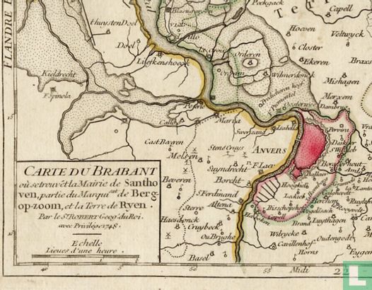
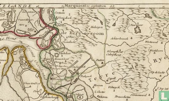
Kaart van West Brabant uit 1748 van Robert de Vaugondy


Catalogue information
LastDodo number
4289551
Area
Maps and globes
Title
Kaart van West Brabant uit 1748 van Robert de Vaugondy
Type
Manufacturer / publisher
Country of publication
Cartographer / designer
Year
1748
Print Run
Collection / set
Number in collection
Addition to number
Scale
Continent
Country
Not independent areas
Former countries and colonies
Region / province
City
Material
Type of colouring
Language / dialect
Theme
Dimensions
17 x 20 cm
ISBN13
ISBN10
Details
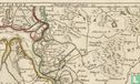
Map of West Brabant from 1748 by Robert de Vaugondy. Title: Carte Du Brabant. Map from Atlas Portative Universel, published in 1748 by Robert de Vaugondy. Original copper engraving, slightly original colored, in good condition, dimensions 17 x 20 cm. On the map the western part of Brabant and part of Flanders. The area around Bergen op Zoom, the Oosterschelde and Antwerp.
This text has been translated automatically from Dutch
Click here for the original text
Kaart van West Brabant uit 1748 van Robert de Vaugondy.
Titel: Carte Du Brabant.
Kaart uit Atlas Portatief Universel, uitgegeven in 1748 door Robert de Vaugondy.
Originele kopergravure, licht origineel ingekleurd, in goede staat, afmetingen 17 x 20cm.
Op de kaart het westelijke deel van Brabant en een deel van Vlaanderen.
Het gebied rond Bergen op Zoom, de Oosterschelde en Antwerpen.