
Enlarge image
Zijden Ontsnappings- Kaart Helsinki/Trondheim


Catalogue information
LastDodo number
4120849
Area
Maps and globes
Title
Zijden Ontsnappings- Kaart Helsinki/Trondheim
Manufacturer / publisher
Country of publication
Cartographer / designer
Year
1945
Print Run
3
Collection / set
Number in collection
2758
Addition to number
Scale
Continent
Not independent areas
Former countries and colonies
Region / province
Material
Type of colouring
Language / dialect
Dimensions
106 x 63
ISBN13
ISBN10
Details
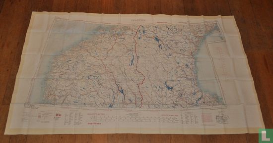
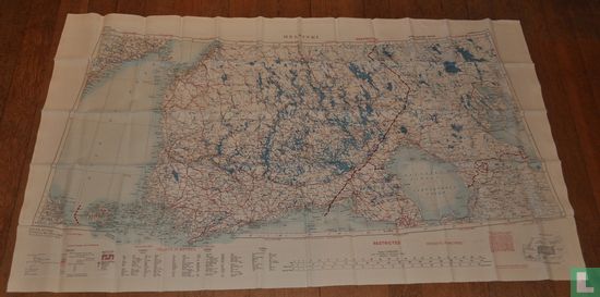
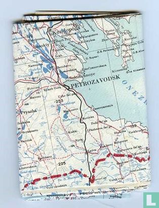
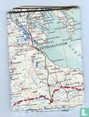
Silk Escape Card Helsinki / Trondheim "Trondheim" on the one hand depicts Norway and Sweden. "Helsinki" on the other hand represents Finland and the Western part of Russia. Originally issued for British pilots during the Cold War. If they were shot, these 100% silk topographical and political maps of Eastern European regions could show the most useful escape routes, including railways, rivers, mines, swamps, etc. Printed on both sides of silk so they would remain legible and usable should the card get wet. Issued by the British War Office in 1945. This is the Third Edition edited by O.S. in 1952.
This text has been translated automatically from Dutch
Click here for the original text
Zijden Ontsnappings- Kaart Helsinki/Trondheim
"Trondheim" aan de ene kant verbeeldt Noorwegen en Zweden. "Helsinki" aan de andere kant geeft Finland en het Westelijk deel van Rusland weer. Oorspronkelijk uitgegeven voor Britse piloten gedurende de Koude Oorlog. Als zij zouden zijn neergeschoten dan konden deze 100% zijden topografische en staatkundige kaarten van Oost Europese streken de meest bruikbare vluchtroutes tonen, inclusief spoorwegen, rivieren, mijnen, moerassen e.d . Dubbelzijdig gedrukt op zijde zodat ze leesbaar en bruikbaar bleven als de kaart nat zou worden.
Uitgegeven door de Britse War Office in 1945.
Dit is de derde Editie die is bewerkt door O.S. in 1952.