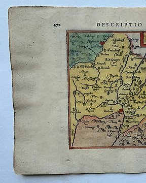
Afrique, Carte - Afrique de l'Ouest, Sénégal, Guinée, Nigeria, Mali, Côte d'Ivoire, Ghana, Libéria, Togo, Bénin; Bertius Petrius - Guinea - 1601-1620
Nº 82139507

Nº 82139507
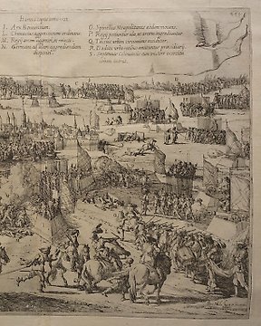
Map of the city of Reesa
Engraving.
61.5 x 72 cm.
BLAEU, Willem Janszoon (1571 Alkmaar - 1638 Amsterdam) copper engraving. Framed & behind glass: 61.5 x 72 cm. 2-sided glazed sheet with an outline of the town of Reesa on the Rhine from a bird's eye view, inscribed "Rhees", description in Latin on the verso, from "Novus Atlas, This is a description of the world / with beautiful new, detailed country plates engraved in Kupffer and given the day by Guil". Glued back fold, slightly foxed. Dutch cartographer, engraver and publisher. The 11-volume "Atlas Maior", published by the Blaeu family, was one of the most expensive and elaborate atlases of the 17th century. Very fresh condition.
Comment acheter sur Catawiki ?
1. Découvrez des objets d’exception
2. Faites la meilleure offre
3. Effectuez un paiement sécurisé