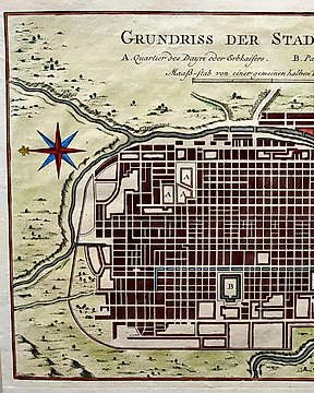
Asie, Plan de ville - Japon / Kyoto; J van der Schley / JN Bellin - Plan de la Ville de Meaco - 1752
Nº 82173021
Nº 82173021
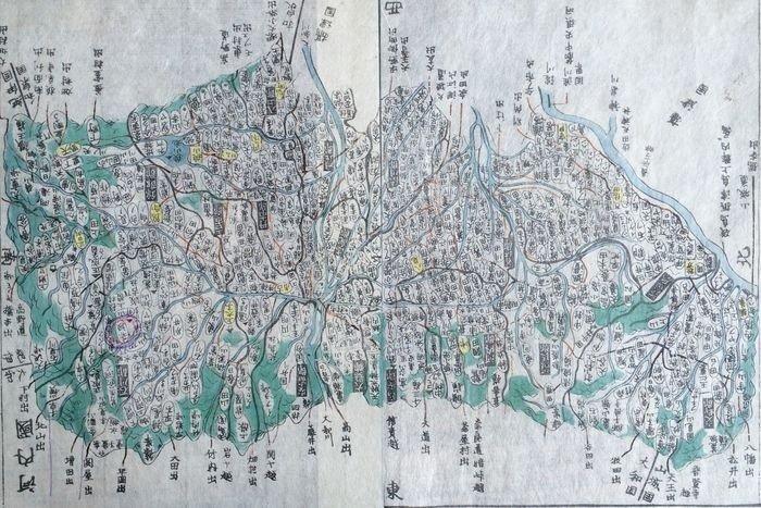
TADATAKA, Ino (compiled by Aoo, Motonobu & Eirakuua, Toshiro.)
Map of Kawachi (河内国, Kawachi no kuni), taken from Kokugun Zenzu / Atlas of Japan (De luxe version)
Japan: 1830.
A map of the Kawachi Province. 河内国, (Kawachi no kuni) is a former province of Japan, situated in the current prefecture Osaka. Kawachi was situated next to the provinces Kii, Izumi, Yamato, Settsu and Yamashiro. Printed on two pages (fixed together) on rice paper. Produced as part of Kokugun Zenzu (Atlas of Japan), mapped and prepared by Ino Tadataka, and compiled after his death by Motonobu Aoo and Toshiro Eirakuua. This map is taken from the De-Luxe version of the map (the standard version was slightly smaller and printed on thinner paper). Contemporary colouring.
Map measures 215 by 320mm (8½ by 12½ inches). A very nice clean copy. Strong colouring. No chips or tears.
Ino Tadataka (1745-1818) was a Japanese surveyor and cartographer and is considered to be one of the fathers of modern Japan. Ino Tadataka was born in Kujukuri, a coastal village in Kazusa Province (Chiba Prefecture) at 17 he was adopted into the prosperous Ino clan. The Ino family were wealth rice merchantS and saki brewers based in Sawara (now a district of Katori, Chiba), a town in Shimo-Usa Province. Ino Tadataka served the family interests for nearly thirty-two years before turning his interests to mathematics, astronomy, and cartography. He moved to Edo (modern Tokyo) and there apprenticed himself to Takahashi Yoshitoki, a specialist in astronomy under the Tokugawa Shogunate. After five years of study he petitioned the Shogun for permission to map the coastline of Japan using modern techniques and his own money. The Shogun approved and Tadataka spent the next seventeen years surveying the country on foot. This monumental work resulted in a map and subsequent atlas of such extraordinary accuracy and detail that would be the definitive mapping of Japan for the next 100 years. The maps and atlases for which Ino Tadataka would be forever known were compiled by his friends and family and published approximately three years after his death. By the late 19th century Ino Tadataka's maps had become the standard for Japanese cartography and were avidly collected by wealthy merchants and bureaucrats throughout Japan. One such, a functionary in the Imperial household, actually managed to collect most of Ino Tadataka's surviving work which he stored in the Royal Palace. When the Palace was destroyed by fire in 1814 most of this prized collection went with it
The map will be sent to you rolled in a professional map tube.
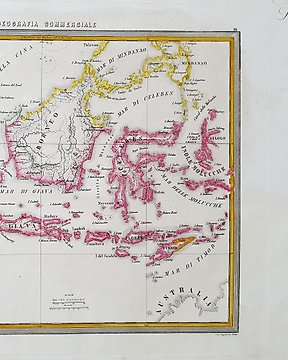
#japanweek
Comment acheter sur Catawiki ?
1. Découvrez des objets d’exception
2. Faites la meilleure offre
3. Effectuez un paiement sécurisé