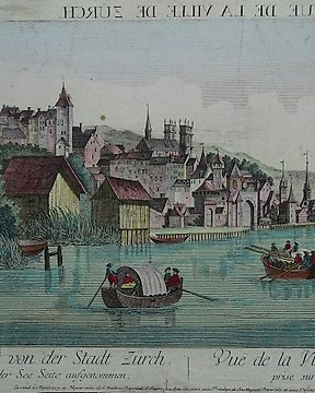
Európa, Térkép - Svájc / Zürich; Leizelt - Vue de la Ville de Zurich - 1761-1780
Nr. 83086369
Nr. 83086369
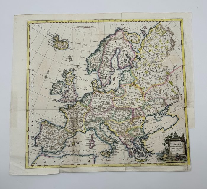
Detailed English map of Europe and Iceland. Interesting 18th Century map of Europe, colored by countries. Includes decorative cartouche.
Techniques: Copper-plate Engraving
Date/Place: 1770
Printed: London, United Kingdom
Size: 38 cm x 42 cm
Condition: Generally very good with the usual light overall toning, wear, there may be minor imperfections to be expected with age. Minor repaires a tergo.
We include the Certificate of Authenticity. This Item is professionally protected by handmade packing.
Hogyan vásárolhatok a Catawiki-n?
1. Fedezzen fel valami különlegeset
2. Tegye meg a legmagasabb licitet
3. Fizessen a biztonságos és védett rendszert használva