Europa, Kort - Spanien; Pazzini Carli - Le provincie di Salamanca, di Guadalaxara, Madrid, Toledo e Mancha - 1791
Nr. 82273533
Nr. 82273533
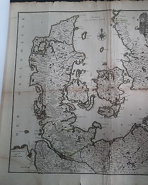
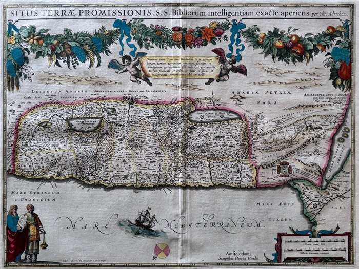
Vintage map published in Amsterdam circa 1630
French text printed on the back
Very good condition
47,5 x 57 cm
This copperplate engraving of the Holy Land is the first in a series of reprints of a map by Christiaan van Adrichem (1533-85) by Dutch publishers in the 17th century. Adrichem was a Roman Catholic priest and biblical scholar, and the map depicts the Holy Land as Adrichem conceived it, based on his study of the scriptures. The map was printed in Amsterdam in 1633 by Henricus Hondius (1597-1651), and was included in a new edition of the Atlas ou representation du monde universel (Atlas, or universal representation of the world) first published by Jodocus Hondius (1563-1612) and Gerhard Mercator (1512-94).
#ExclusiveCabinetofCuriosities
Sådan køber du hos Catawiki
1. Opdag noget særligt
2. Afgiv det højeste bud
3. Foretag en sikker betaling