Europa, Kort - Belgien, Brabant, Bruxelles, Holland [Lot of 2]; R. de Vaugondy / M. Robert - Carte du Brabant: 1, 2, .... - 1721-1750
Nr. 84389339

Nr. 84389339
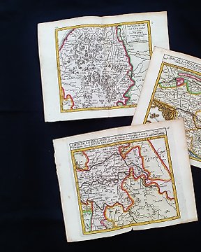
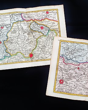
Questa Mappa Geografica, è un'incisione su rame originale del 1748/1749.
Trattasi della rara edizione tascabile di VAUGONDY edita nel 1748/1749 nel suo Atlante, che porta il nome di: "ATLAS PORTATIF Universel et MIlittaire, composè d'apres les meilleurs Cartes tant Gravees que Manuscriptes des plus Celebres Geographes et Ingenieurs..... par M. ROBERT, a Paris, 1748 circa"
Bellissima mappa edita a PARIGI, con ottima coloritura, ampi margini, e geograficamente ben dettagliata in ogni punto.
Condizioni: le condizioni sono veramente più che buone come da foto.
Le misure complessive della mappa sono: Cm 25 X 20
Sådan køber du hos Catawiki
1. Opdag noget særligt
2. Afgiv det højeste bud
3. Foretag en sikker betaling