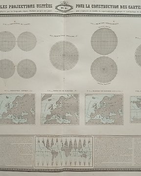
World Map, Map - Earth / Planisphere / Globe; Garnier - Tableau des Principales Projections Usitées pour la Construction des Cartes Géographiques - 1860
No. 82994153
No. 82994153
Tinted lithograph on white paper.
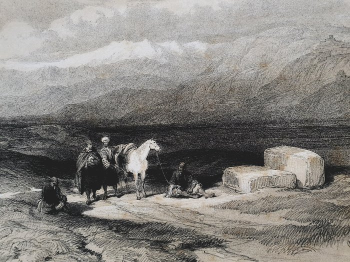
The Phoenician city of Serapat is probably Zarephath (Extinct city)--1840-1850 in modern day Lebanon
Signed in the plate. Inscribed bottom left in the plate "Sarepta", april 27th, 1839".
Tinted lithograph from the volume "The Holy Land, Syria, Idumea, Arabia, Egypt & Nubia", volume 3, published by F. G. Moon, London, 1843.
Condition is good. Some light stains on edge of margins. Foxing. Spots.
How to buy on Catawiki
1. Discover something special
2. Place the top bid
3. Make a secure payment