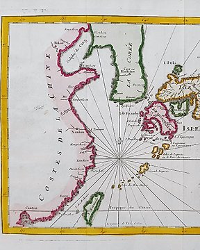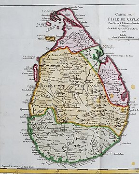
Asia, Map - India / Sri Lanka / Ceylon; La Haye / P. de Hondt / J.N. Bellin - Carte de l'Isle de Ceylan - 1721-1750
No. 83204273
No. 83204273
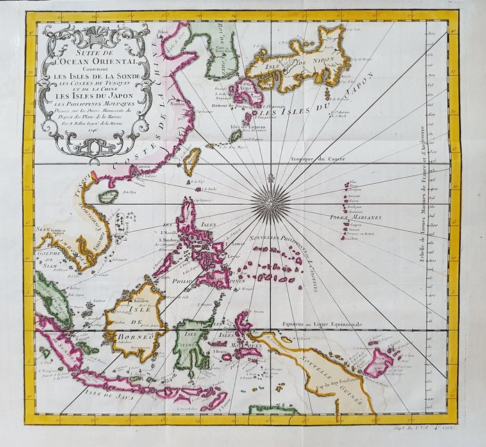
Questa Mappa Geografica, è un'incisione su rame originale del 1747 (XVIII° Secolo).
Trattasi dell'edizione nuova ed aggiornata del BELLIN & PREVOST, editatra il 1747 ed il 1788 ca. nella sua rara Opera, che porta il nome di: "HISTOIRE GENERALE DES VOYAGES....... AMSTERDAM, 1747".
Bella Carta/Veduta Geografica, edita in OLANDA, con ottima inchiostratura ed acquerellatura fantastica, e considerato l'anno di edizione, è geograficamente ben dettagliata in ogni punto.
Condizioni: le condizioni sono veramente più che buone, ottime, come da foto, con la presenza di un piccolissimo restauro abilmente ed anticamente apportato nella zona alta/sinistra della mappa, ben fuori il campo disegnato, che non ne compromette assolutamente la propria rarità e bellezza.
Le misure complessive della mappa sono: Cm 35 X 33
How to buy on Catawiki
1. Discover something special
2. Place the top bid
3. Make a secure payment