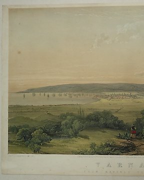
Europe, Town plan - Bulgaria / Varna; A.L. Mansell - Varna from Kafirlu Tepeh - 1851-1860
No. 83768285

No. 83768285
A rare and early map of Stockholm and surroundings beautifully lithographed in three basic colours.
The archipelago in the coastal waters before entering into the actual city of Stockholm is pictured in clear and fine detail.
Scale 1 ; 100 000. The map is folded in a fine carton, measuring 17 x 11 cms. Unfolded the map measures 64 x 50 cms.
Both the carton and map are in a good to very good condition, be it that in the centre of the map are a few small fold-tears. ( as usual ).
The map is published by the Generalstadens Litografiska Anstalt in 1895.
How to buy on Catawiki
1. Discover something special
2. Place the top bid
3. Make a secure payment