1501-1520 Cartography

No active objects in this collection

There are currently no objects for auction, but every week there are 65,000 new objects to explore.

Catawiki Buyer Protection

  • Your payment is safe
  • All objects are quality checked
  • All sellers are verified
Learn more

Related objects

Netherlands, Zuid Limburg, Valkenburg, Dalheim, Luxemburg; Isaac Commelin - De stadt Valkenburg Overvallen Anno 1644 / De Stadt Dalen Verrast Anno 1644 - 1651-1660

De stadt Valkenburg Overvallen Anno 1644 / De Stadt Dalen Verrast Anno 1644. Beautiful double image on one sheet of the conquests of Valkenburg (Limburg) and Dalen (Dalheim in Luxembourg). Above a face on Valkenburg city, below a view on the city of Dalheim (Luxembourg), in the

More

Netherlands, Bergen op Zoom; Jan Jansz - Berghen op Zoom - 1616

Hand-colored copper engraving from Bergen op Zoom. The view of the city in perspective from the south. The title in the middle, interrupted by the pennant decoration. The city coat of arms of Bergen op Zoom above the title. Condition: Good. Sufficient margins, very wide at the

More

Netherlands, Deventer; Jan Jansz - Deventer - 1616

Hand-colored copper engraving from Deventer. The view of the city in perspective from the southwest. The title above the middle, with the intersected coat of arms of Deventer above it. Condition: Excellent. Sufficient margins. A small stain at the top left. Verso: Latin.

More

Netherlands, Groningen; Nicolaes VIsscher, Tjarda a Starckenborgh, - Groningae et Omlandiae Dominium - 1721-1750

Hand-colored copper engraving of the province of Groningen. The title above, with the compass rose below. Bottom left the legend with scale stick. In the legend cartouche the coat of arms of Groningen. Condition: Fair. The margins left, right and top are cut short into the map

More

Netherlands, Town plan - Montfoort; I Tirion & H Spilman - De Stad Montfoort, van de Willeskopper-Poort (...) - 1751-1760

Wide margins. With vertical folds as issued. Verso: blank. Published by Isaak Tirion in Amsterdam around 1758. Engraved by Hendrik Spilman after a drawing by Jan de Beijer from 1744.

More

Belgium, Map - Vlaanderen & Zeeland; Willem Blaeu - Flandria et Zeelandia Comitatus - 1661-1680

Flandria et Zeelandia Comitatus. By Willem Blaeu, 1662. Contemp. hand col., in cardboard frame, verso Latin text. 42 x 53 cm. Good, somewhat browned. -- Shipped without passe-partout.

More

Netherlands, Map - Helmond; L Guicciardini / WJ Blaeu - Hoc est ciutas Hellmonda per quam Excellentia sua de Nassou cum toto exercitu transibat, (...) - 1613

Centrefold as issued. Wide margins. Verso: blank. City map of Helmond with elevations of buildings and houses. The entry of Maurice's troops is also depicted. Title bottom left. Compass rose top left. Published in 1613 by Willem Jansz. Blaeu in Amsterdam in 'Omnium Belgii, sive

More

Simon Wynouts Frisius (Simon de Vries) (circa 1580-1629) - Adolf van Nieuwenaar tijdens de slag bij Amerongen, uit: Willem Baudartius - De Nassausche Oorloghen

Simon Frisius, Adolf van Nieuwenaar during the battle of Amerongen, from: Willem Baudartius - The Nassauce Wars, Images and descriptions of all the battles and sieges, etc. (1616). Adolf van Nieuwenaar was, among other things, Count of Meurs and, as a Dutch army commander, lost

More

Netherlands, Town plan - Delft; Isaak Tirion - Plattegrond van de stad Delft [1742] - 1721-1750

Available again after more than 40 years: an original print from: Present State of the United Netherlands (...). Amsterdam: Isaak Tirion, 1742, vol. 4, p. 429. An identical print is also part of the collection in the Rijksmuseum.

More

Netherlands, Town plan - Holly; Frans Hogenberg. / Willem Baudartius - Hulst - 1616

Wide margins. Verso: French text. Hand-coloured copper engraving, published in 1616 in "Les guerres de Nassau", Willem Baudartius.

More

Netherlands, Map - South Holland; Halma - Descriptio Batavorum Insulae et Continentis - 1725

Dimensions: 32 x 42 cm. (on sheet: 39 x 48.5 cm.). Condition: good (minor foxing) Verso: blank. Publisher: H. Halma. Leeuwarden. Note: from "Tooneel der Verenigde Nederlanden (...)" François Halma (Langerak, January 3, 1653 – Leeuwarden, January 13, 1722) was a Dutch printer,

More

Netherlands, Map - Nijmegen; Matthäus Merian, uitgave Hoffman, 1646 - Neomagum - Nümmegen - 1621-1650

Neomagum Nummegen. Copper engraving by Matthäus Merian. From: Johann Ludwig Gottfried. Newe Archontologia Cosmica, Das ist Beschreibung aller Kayserthumben, Königreichen und Republicken der gantzen Welt, ……………… Franckfurt a. M.: Hoffman, 1646. City map. Buildings and houses in

More

Netherlands, Map - St Andriesfort, Heerewaarden, between Maas and Waal, Gelderland; Johannes Blaeu - Stedenatlas - 1621-1650

Original copper engravings of maps of Fort St Andries and Fort Nassau, De Voorn. The Gelderland Fort St Andries, located between the Maas and Waal, was invested by the Spanish in 1600 and conquered by Prince Maurits, son of William of Orange. With Dutch explanation of the course

More

Holland - Belgium, Map - Map of the XVII Provinces; Henri Chatelain, Amsterdam - Nouvelle Carte des Dix-sept Provinces des Pays-Bas - 1701-1720

Map of the XVII Provinces (Henri Chatelain, 1720 Amsterdam). No defects or comments, this card is in excellent condition. With blank back. The map is in the French language and hand-coloured upon publication. There is a description of the individual areas, an alphabetical index

More

Netherlands, Atlas - Zealand; "De Heeren Hattinga" - (Hattinga's) Atlas van Zeeland - 1721-1750

"Atlas of Zeeland, containing accurate maps of all the islands ....., geometrically recorded by the Heeren Hattinga, during the years 1744 to 1752, as well as Ground Drawings and Views of the Cities, Images of the main Public Buildings, Villages, Locks, Manor Houses etc. drawn

More

Netherlands, Town plan - Groenlo; M. Merian - Grolla obsessa et expugnata - Approx. 1650

Dimensions: 27 x 34.5 cm. Copper engraving published in Matthias Merian, Theatrum Europaeum, Frankfurt am Main, ca. 1650. Fold as issued. Wide margins. Hand colored. Secured shipment.

More

Netherlands, Town plan - The Hague; Frans Hogenberg. - Delft - Haghe - Leyden - 1581-1600

Dimensions: 20 x 29.5 cm. Condition: excellent. Center fold as published. Hand colored. Copper engraving by Frans Hogenberg 1582, published in 1596 in Cologne by Gerardus Campensis in; "De Leone Belgico eiusq(ue) historica descriptione liber", Michael Aitzinger (Also called;

More

Netherlands, Town plan - Zwolle; L. Guicciardini / W. Blaeu - Swolla (...) - 1612

23 x 31 cm. Copper engraving published in L. Guicciardini, "Description of all the Dutch countries otherwise called Neder-Duytslandt". Published by Willem Blaeu in Amsterdam, a.d. 1612. Center fold as published. Shipping: insured.

More

Netherlands, Town plan - Rotterdam; L. Guicciardini / W. Blaeu - Rotterdam - 1612

25 x 33 cm. Copper engraving published in L. Guicciardini, ‘Beschryvinghe van alle de Neder-landen anderssins ghenoemt Neder-Duytslandt’. Published by Willem Blaeu in Amsterdam in AD 1612. Hand-coloured. Centrefold is as published. Insured shipping.

More

Netherlands, Town plan - Utrecht; Lodovico Guicciardini / W. Blaeu - Trajectum - 1601-1620

Dimensions: 23 x 31 cm. Condition: excellent. Adequate margins. Centrefold is as issued. Verso: blank. Hand-colouring. Copper engraving published in L. Guicciardini’s "Beschryvinghe van alle de Neder-landen anderssins ghenoemt Neder-Duytslandt". Published by Willem Blaeu in

More

Netherlands, Town plan - Alkmaar; Lodovico Guicciardini /W. Blaeu - Alcmaer - 1601-1620

24 x 33 cm. Copper engraving published in; L. Guicciardini, "Description of all the Dutch countries otherwise called Neder-Duytslandt". Published by Willem Blaeu in Amsterdam, a.d. 1612. Fold as published. secured shipment

More

Netherlands, Town plan - Amsterdam; Daumont - Civilis Consilii Basilica Amstellodami - 1751-1760

Dimensions: 27 x 41 cm. Sufficient margins. Old-fashioned coloured. Copper engraving published as an optic print by Daumant in Paris. Approx. 1760. secured shipment

More

Netherlands, Atlas - North(-West) Brabant; Cornelis Pietersz., Jan Sijmonsz., Jacob Bos, Adan e.a. - Polders in Kaart Noord-West Brabant 1565-1590 + Het Hertogdom Brabant in Kaart en Prent - 1565-1795

1- Polders in Map North-West Brabant 1565-1590 - Willem van Ham, Karel Leenders - Zwolle, WBooks i.s.w. Kunstcommissie Waterschap Brabantse Delta, 2018 - 128 pp + 2 loose maps in facsimile - hardcover - 35 × 25 cm. In new condition (still sealed). Complete with 2 facsimile maps

More

Netherlands, Atlas - West, North, East and South Netherlands; Dienst der Militaire Verkenningen - Grote Historische Atlas van Nederland (in 4 delen: West-, Noord-, Oost- en Zuid-Nederland) - 1838-1859

Grote historische Atlas van Nederland 1 : 50,000. With introductions by P.W. Geudeke and Drs. K. Zandvliet - Cartography: Dienst der Militaire Verkenningen, Den Haag - Groningen, Wolters-Noordhoff, 1990. Volume 1: West-Nederland 1839 -1859: 16 pp. with introduction and 103 pp.

More

How to buy on Catawiki

Discover something special - 1501-1520 Cartography
1. Discover something special

Browse through thousands of objects in auction selected by experts.
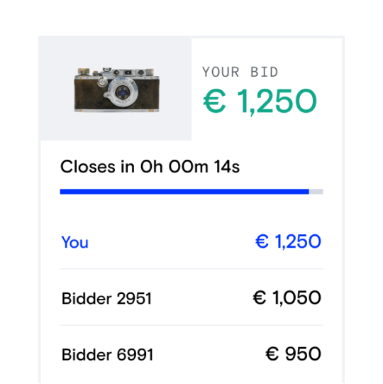
Place the top bid - 1501-1520 Cartography
2. Place the top bid

When you find something you love, create your free account to start bidding!

Pay and enjoy! - 1501-1520 Cartography
3. Pay and enjoy!

Pay for your object to officially make it yours. We partner with trusted licensed payment providers to keep your money safe.