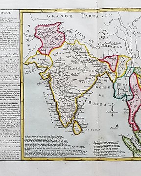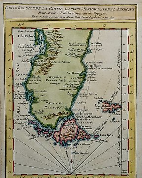
Ameryka Południowa, Mapa - Chile, Argentyna, Ziemia Ognista Cieśnina Magellana; J.N. Bellin - Carte Reduite de la Partie la Plus Meridionale de L’Amerique. - ok. 1760
Nr 83433041

Nr 83433041
Dimensions: 27 x 38 cm. (on sheet: 30.5 x 47.5 cm.).
Condition: very good (minor foxing)
Verso: blank.
Engraver: J. Couché
Publisher: Dauphine. Paris
Note: from "Campagnes des Francais sous le Consulat et Empire (...)"
Carle Vernet, Carle also called Charlot, original name Antoine-Charles-Horace Vernet, (born August 14, 1758, Bordeaux, France—died November 27, 1836, Paris), French painter of battle scenes for Napoleon I and of sporting subjects, notably horses, for King Louis XVIII.
Jak kupować w serwisie Catawiki
1. Odkryj coś wyjątkowego
2. Złóż najwyższą ofertę
3. Dokonaj bezpiecznej płatności