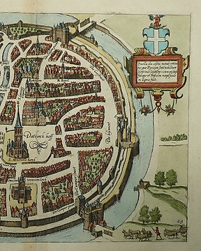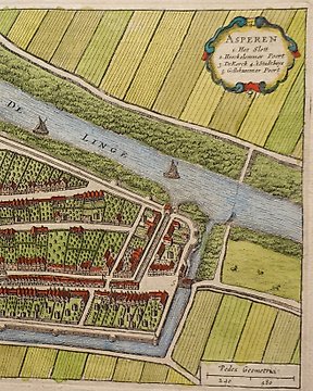
Holandia, Plan miasta - Asperen; Joan Blaeu - Asperen - 1649
Nr 83542223

Nr 83542223
Hand-coloured copper engraving published in L. Guicciardiniʼs "Description of all the Dutch countries otherwise called Neder-Duytslandt". Published by Willem Blaeu in Amsterdam, 1612.
Dimensions
31 cm x 23 cm
Artist or Maker
Willem Blaeu
Medium
Engraving
Date
1612
Condition Report
This work is in very good to excellent condition overall. Trimmer Alingsås/within platemark. Please review the images carefully for condition and contact us with any questions.
This item is professionally protected by handmade packing.
The Certificate of Authenticity is included.
Jak kupować w serwisie Catawiki
1. Odkryj coś wyjątkowego
2. Złóż najwyższą ofertę
3. Dokonaj bezpiecznej płatności