Europa, Hartă - Italia; Christoph Cellarius - [Lot of 4 maps] Italia Antiqua / Graecia Magna sive pars ultima Italiae / Italia Media sive propria - 1721-1750
Nr. 83080925
Nr. 83080925
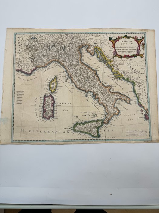
A Map of Italy with its Kingdoms, States &c.: Tindal and Rapin 1750
Map of Italy divided into its various city-states. Includes Sardinia, Corsica, and Sicily, as well as parts of France, Germany, Switzerland, and European Turkey. Legend at lefthand margin explains the use of various symbols indicating the locations of capital cities, archbishoprics, universities, castles, principalities, dukedoms, and republics
Title: A Map of Italy with its Kingdoms, States &c.
Author: Nicholas Tindal and Paul de Rapin
Date: 1750
Medium: Hand-colored copperplate engraving
Condition: Very Good - light age toning and foxing, issued center fold, minor paper tears repaired a tergo along lower margin, minor spots across image
Inches: 21 1/4 x 17
Centimeters: 54 x 44
Condition Report
The work is in very good to excellent condition overall. Please review the image carefully for condition and contact us with any questions.
This Item is professionally protected by handmade packing. The Certificate of Authenticity is included.
Cum să cumperi de la Catawiki
1. Descoperă ceva special
2. Plasează cea mai mare ofertă
3. Fă o plată sigură