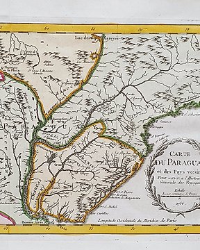
Mellanöstern, Karta - helig mark; Calmet - Carte de la Terre Promise - 1722
Nr 78474417

Nr 78474417
Dimensions: 18 x 24.5 cm. (on sheet: 22 x 27.5 cm.).
Condition: very good (minor foxing)
Verso: latin text
Mapmaker: H. Hondius, Amsterdam
Henricus Hondius was born in Amsterdam, the son of the famous cartographer Jodocus Hondius who had started a map-making business in the city. Henricus obtained the original plates of the Mercator 1569 world map, and published a 1606 version of it. The first time his name was mentioned in an atlas was in 1623 when he published the fifth edition of the Mercator-Hondius atlas. After 1628 Henricus partnered with the cartographer Jan Janssonius and together they continued the business.
Hur du köper på Catawiki
1. Upptäck något speciellt
2. Lägg det högsta budet
3. Gör en säker betalning