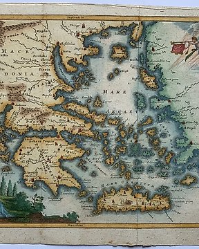
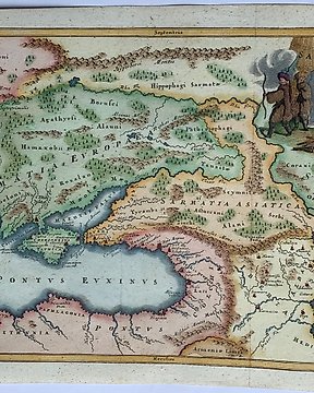
Europa, Karta - Frankrike / Poitiers; Belleforest - De la Ville de Poytiers - 1575
Nr 78474507

Nr 78474507
Dimensions: 21 x 25 cm. (on sheet: 22.5 x 27.5 cm.).
Condition: very good (minor foxing)
Verso: blank
Publisher: C. Bunonis.
Note: from " Introductio in universam geographiam tam veterem..."
Philipp Clüver (latinized as Philippus Cluverius) was an antiquary, who was given a special appointment at Leiden as geographer and put in charge of the university's library, but his life's project, it developed, was a general study of the geography of Antiquity, based not only on classical literary sources, but – and this was his contribution – supplemented by wide travels and local inspections. He became virtually the founder of historical geography.
Hur du köper på Catawiki
1. Upptäck något speciellt
2. Lägg det högsta budet
3. Gör en säker betalning