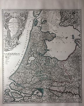
Nederländerna, Karta - Holland; J.B. Homann - Tabvla Comitatvs Hollandiæ - 1712
Nr 82139507

Nr 82139507
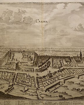
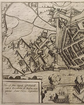
Map of the city of Reesa
Engraving.
61.5 x 72 cm.
BLAEU, Willem Janszoon (1571 Alkmaar - 1638 Amsterdam) copper engraving. Framed & behind glass: 61.5 x 72 cm. 2-sided glazed sheet with an outline of the town of Reesa on the Rhine from a bird's eye view, inscribed "Rhees", description in Latin on the verso, from "Novus Atlas, This is a description of the world / with beautiful new, detailed country plates engraved in Kupffer and given the day by Guil". Glued back fold, slightly foxed. Dutch cartographer, engraver and publisher. The 11-volume "Atlas Maior", published by the Blaeu family, was one of the most expensive and elaborate atlases of the 17th century. Very fresh condition.
Hur du köper på Catawiki
1. Upptäck något speciellt
2. Lägg det högsta budet
3. Gör en säker betalning