

亚洲, 地图 - 满洲国; Toppan Printing Co. - Schematic map of Manchukuo - 1937 - 1921-1950
编号 83301301
编号 83301301
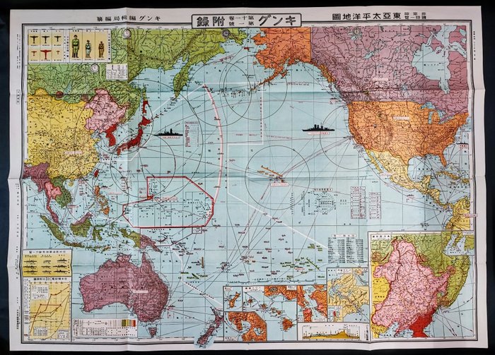
This is an "East Asia Pacific Map and Emergency National Defense Capability Overview Map" published in 1934.
It's an old map from the era when Japan held territories in mainland China, in addition to its current territory.
It's quite old, being released in 1934, but the condition seems to be very good.
Size
110cm×79cm
43.3 inches x 31.1 inches
*Italian buyers are required to submit Codice Fiscale for customs clearance procedures.
"Please note that VAT (IVA) and import taxes will be billed separately from the winning bid price.
European customs duties are higher than those in Asia or America. If concerned, please check before bidding.
(Condition)
There may be dirt or other signs of wear due to aging. Please bid with understanding.
(Shipping)
Value-added tax, customs duties, and clearance fees apply. These charges are imposed and collected by the customs or courier service in your region. Import duties are the responsibility of the buyer.
*Some countries may not be eligible for shipping from Japan."


