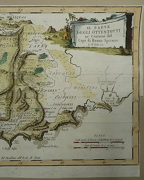
非洲, 地图 - 南非 / 开普敦; J.N. Bellin / V. Formaleoni - Il Paese degli Ottentotti - 1781-1800
编号 83586595

编号 83586595
11 African 18th-20th C maps.
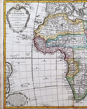
1. Continent of Africa (27x34 cms) by J Rapkin for John Tallis . c.1850. Central vertical fold..
2. Continent of Africa and the Atlantic (31x29 cms) by J & C Walker for Edward Stanford. c. 1860 small stains verso and corner folds.
3. African Continent (28x35 cms) by J Rapton for the London Printing and Publishing Company c. 1850. Two vertical folds for book insertion. Crease lower right.
4. Map of West Africa (22x32 cms), coloured showing colonial possessions. For John Bartholemew’s Citizen Atlas. c 1860. Slight wrinkles from binding strip at top.
5. Coste D’Afrique et les isles comprise enter le Cap Rouge at La Rivière de Nunhead.(25x29cms) French 1780’s. Good Codition with fold for book insertion..
6. ‘Maps of Africa, Upper Guinea, and the Gold Coast, showing the sire of the Ashantee war’. ( 27x38 cms) From The Illustrated London News. Sept 27 1873. Pencil underlining of Ashantee.
7. ‘ Countries in the Northern Tropical Regions of Africa’ : Abyssinia and Central Africa. (47x32cms) c.1870’s. Spotting on the lithograph. Frayed left edge.
8. West Africa (34x41cms) by J&C Walker. Showing the route of the Niger River. c. 1860’s, spotting stains verso.
9. 2 Maps on one sheet. Morocco, Algeria & Tunis., and West Africa (44x33 cms), for Hohn Bartholemew & Son. c. 1899. Folding hinge horizontally.