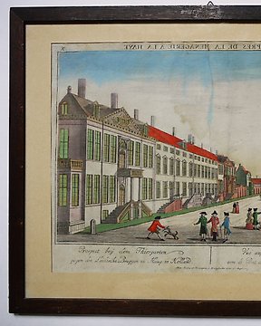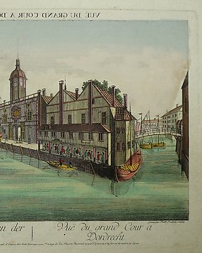
荷兰, 城镇规划 - 多德雷赫特; F. Leizelt - Prospect von dem grossen Hof in der Stadt Dordrecht - 1721-1750
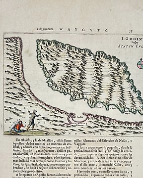
编号 83877865
编号 83877865
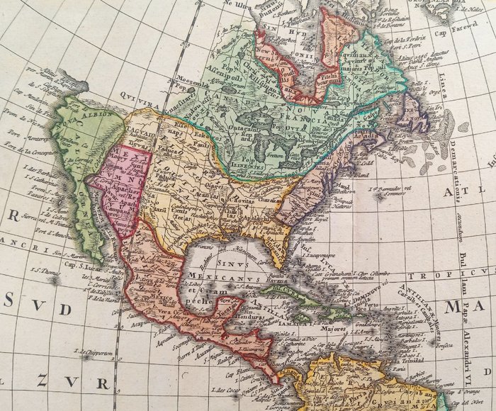
BEAUTIFUL MAP OF AMERICA & WESTERN HEMISPHERE by Johann Baptist Homann (1664-1724). Original hand coloured copper engraving. Very good condition, taken directly from the original volumes, with wide and original margins, centre fold as published, strong heavy paper with chain lines and two watermarks. This highly decorative map depicts the AMERICAS as it was known in the 1740’s. From the Homann's Atlas Scholasticus with no text on verso. Engraved by August Gottlieb Böhme (1719-1797) and Johann Matthias Hase (1684-1742).
Title: AMERICAE mappa generalis: secundum legitimas projectionis stereographicae regulas, relationesque recentissimas et observationes...(A general map of AMERICA: according to the legitimate rules of stereographic projection, with the most recent reports and observations...). Published in Nuremberg, MDCCXXXXVI [1746] by Homann Heirs.
Size and Description: H 495 x W 567 mm or 19.5 by 22.3 inches. At least three states of the 1746 map exist: this is the state with no privilege statement, but it has an engraver's statement near the date line in Roman numerals. Nice example of the Homanns' second map of America, which reflects the substantial new information obtained since the issuance of the first map of America by the patriarch of the Homann Family, Johann Baptiste Homann. The decorative cartouche includes some very lively visual imagery, including volcanos and a nice allegorical scene representing the people, flora and fauna of America. The interior of North America benefits from the knowledge obtained by the Jesuits in the Interior parts of North America, especially along the Mississippi River and English and Dutch information along the coast. The French are still the dominant force in the North, the Spanish in the South, immediately prior to the French and Indian War (1754–1763). The Great Lakes are only just now being accurately charted by D'Anville and later Mitchell. The west coast conforms to the French updates provided by De L'Isle and progeny. South America is substantially corrected from earlier models. The North West Coast of America and NW Passage are still unknown, but wishfully shown. Quivira is shown considerably east of its normal location. Quivira was the the legendary land of gold and silver. Francisco de Coronado began his search for Quivira in 1541, but found only Indian Villages. He did however report to the Spanish King that the land was suitable for growing all of the products of Spain. Quivira migrated progressively further North and East, until it disappeared in the late 18th Century. The map seems to be influenced primarily by the highly influential map of America by De L'Isle first issued in 1700, although the Haas retains some of the great mythical cartographic features in the interior regions. Map is in very good condition, with wide and original margins, normal signs of aging, with some small stains and tears on the white margins outside the large yellow frame and which do not affect the text or illustrations, some signs of old restoration on the back, strong heavy paper with chain lines and two watermarks. There may be a few minor imperfections to be expected with age. Please review the image carefully for condition and contact us with any questions.
Author/Cartographer: German engraver and publisher Johann Baptist Homann (1664-1724) and his family were the most famous German map publishers of the mid-18th century. Following Homann's death in 1724, the business continued under the name Homann Heirs with their most recognizable maps being the present Americae Mappa generalis and the Mappe Monde Planiglobii Terrestris.
References: Lowery Collection #383; Wagner #1746; Phillips, Lee Philip, A List of Geographical Atlases in the Library of Congress, page 44; French Josephine (2001). Tooley's Dictionary of Mapmakers, Revised edition, volume 2. Riverside, CT: Early World Press. p. 361; Adolf Brecher: Johann Baptist Homann. In: Allgemeine Deutsche Biographie (ADB). Band 13, Duncker & Humblot, Leipzig 1881, S. 35–38; Michael Hochedlinger: Die Ernennung von Johann Baptist Homann zum kaiserlichen Geographen im Jahre 1715. In: Cartographica Helvetica. Heft 24, 2001, S. 37–40.
Shipping: via UPS, DHL, National Postal Services, protected, INSURED and fully tracked package. Estimated time for Europe 3-5 working days. Shipping within one working day, you can combine shipping if you purchases several items from us, saving money and time.