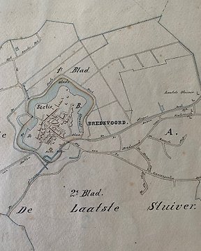
編號 82907961

無法使用
歐洲, 地圖 - 義大利/地中海/科西嘉島/撒丁島/西西里島/達爾馬提亞/義大利; Abraham Ortelius / Giacomo Castaldi - Italiae Novissima Descriptio Auctore Iacobo Castaldo Pedemontano - 1581-1600
競投已結束
2 週前

歐洲, 地圖 - 義大利/地中海/科西嘉島/撒丁島/西西里島/達爾馬提亞/義大利; Abraham Ortelius / Giacomo Castaldi - Italiae Novissima Descriptio Auctore Iacobo Castaldo Pedemontano - 1581-1600

HIGHLY DECORATIVE MAP OF ITALY AND MEDITERRANEAN SEA by Abraham Ortelius (1527–1598). Original hand coloured copper engraving in very good condition, taken directly from the original volumes, with wide and original margins, no particular cuts or defects to report, normal signs of aging, strong heavy paper with chain lines and a watermark as the photos show. This beautiful map depicts ITALY AND THE BIGGEST ISLANDS LIKE SARDINIA, SICILY AND CORSICA and part of the coast of Slovenia, Croatia, Bosnia and Herzegovina, Montenegro and Albania, as it was known in the 1570’s. This is the French edition of Theatrum Orbis Terrarum with French text on verso. According to Van Den Broecke Ortelius used Giacomo Gastaldi's 1543 Venice-published map of Italy as a source, and according to Philip Burden, Gastaldi's 1548 edition of Ptolemy's Geography, "was the most comprehensive atlas produced between Martin Waldseemüller's Geographia of 1513, and the Abraham Ortelius Theatrum of 1570. Title: Italiae Novissima Descriptio Auctore Iacobo Castaldo Pedemontano (Latest Description of Italy by Giacomo Castaldi Piedmontese). Published in Antwerp by Plantin Press in 1587, and in only 250 copies as claimed by Dr. Marcel van den Broecke (Cartographica Neerlandica). Size & Description: Height 430 x Width 564 mm (16.9 x 22.2 inches). Centre fold as published. Original intact and wide margins. The map is in very good condition with beautiful colours and minor signs of age and use, wide and intact margins, the laid paper is watermarked with a coat of arms. Very detailed map, rich in precious decorations and cartouches, the sea is crossed by ancient ships and monsters, there is a reference to mythology with the figure of the God Neptune emerging with a sea nymph from the Mediterranean Sea, the title of map and the author's name are in the top right corner. Rare decorative map of Italy and Mediterranean Sea from Ortelius' Theatrum Orbis Terrarum, the first modern atlas of the world. Author/Cartographer: Abraham Ortelius (1527–1598) was a Brabantian cartographer, geographer, and cosmographer, conventionally recognized as the creator of the first modern atlas, the Theatrum Orbis Terrarum (Theatre of the World). Along with Gemma Frisius and Gerardus Mercator, Ortelius is generally considered one of the founders of the Netherlandish school of cartography and geography. He was a notable figure of this school in its golden age (approx. 1570s–1670s) and an important geographer of Spain during the age of discovery. The publication of his atlas in 1570 is often considered as the official beginning of the Golden Age of Netherlandish cartography. He was the first person proposing that the continents were joined before drifting to their present positions. References: Van der Krogt 3 - 7000:31B; Borri - #45; Van den Broecke - #118; Koeman/Meurer: 112. Shipping: via UPS, DHL, National Postal Services, protected, INSURED and fully tracked package. Estimated time for Europe 3-5 working days. Shipping within one working day, you can combine shipping if you purchases several items from us, saving money and time.

編號 82907961

無法使用
歐洲, 地圖 - 義大利/地中海/科西嘉島/撒丁島/西西里島/達爾馬提亞/義大利; Abraham Ortelius / Giacomo Castaldi - Italiae Novissima Descriptio Auctore Iacobo Castaldo Pedemontano - 1581-1600

歐洲, 地圖 - 義大利/地中海/科西嘉島/撒丁島/西西里島/達爾馬提亞/義大利; Abraham Ortelius / Giacomo Castaldi - Italiae Novissima Descriptio Auctore Iacobo Castaldo Pedemontano - 1581-1600

HIGHLY DECORATIVE MAP OF ITALY AND MEDITERRANEAN SEA by Abraham Ortelius (1527–1598). Original hand coloured copper engraving in very good condition, taken directly from the original volumes, with wide and original margins, no particular cuts or defects to report, normal signs of aging, strong heavy paper with chain lines and a watermark as the photos show. This beautiful map depicts ITALY AND THE BIGGEST ISLANDS LIKE SARDINIA, SICILY AND CORSICA and part of the coast of Slovenia, Croatia, Bosnia and Herzegovina, Montenegro and Albania, as it was known in the 1570’s. This is the French edition of Theatrum Orbis Terrarum with French text on verso. According to Van Den Broecke Ortelius used Giacomo Gastaldi's 1543 Venice-published map of Italy as a source, and according to Philip Burden, Gastaldi's 1548 edition of Ptolemy's Geography, "was the most comprehensive atlas produced between Martin Waldseemüller's Geographia of 1513, and the Abraham Ortelius Theatrum of 1570.

Title: Italiae Novissima Descriptio Auctore Iacobo Castaldo Pedemontano (Latest Description of Italy by Giacomo Castaldi Piedmontese). Published in Antwerp by Plantin Press in 1587, and in only 250 copies as claimed by Dr. Marcel van den Broecke (Cartographica Neerlandica).

Size & Description: Height 430 x Width 564 mm (16.9 x 22.2 inches). Centre fold as published. Original intact and wide margins. The map is in very good condition with beautiful colours and minor signs of age and use, wide and intact margins, the laid paper is watermarked with a coat of arms. Very detailed map, rich in precious decorations and cartouches, the sea is crossed by ancient ships and monsters, there is a reference to mythology with the figure of the God Neptune emerging with a sea nymph from the Mediterranean Sea, the title of map and the author's name are in the top right corner. Rare decorative map of Italy and Mediterranean Sea from Ortelius' Theatrum Orbis Terrarum, the first modern atlas of the world.

Author/Cartographer: Abraham Ortelius (1527–1598) was a Brabantian cartographer, geographer, and cosmographer, conventionally recognized as the creator of the first modern atlas, the Theatrum Orbis Terrarum (Theatre of the World). Along with Gemma Frisius and Gerardus Mercator, Ortelius is generally considered one of the founders of the Netherlandish school of cartography and geography. He was a notable figure of this school in its golden age (approx. 1570s–1670s) and an important geographer of Spain during the age of discovery. The publication of his atlas in 1570 is often considered as the official beginning of the Golden Age of Netherlandish cartography. He was the first person proposing that the continents were joined before drifting to their present positions.

References: Van der Krogt 3 - 7000:31B; Borri - #45; Van den Broecke - #118; Koeman/Meurer: 112.

Shipping: via UPS, DHL, National Postal Services, protected, INSURED and fully tracked package. Estimated time for Europe 3-5 working days. Shipping within one working day, you can combine shipping if you purchases several items from us, saving money and time.

設置搜索提醒
設置搜索提醒,以便在有新匹配可用時收到通知。

該物品在


如何在Catawiki上購買

了解更多有關買家保護

      1. 發現獨特物品

      瀏覽專家挑選的數千件獨特物品。查看每件獨特物品的照片、詳情和估價。 

      2. 出價最高

      找到您喜歡的物品並作出最高的出價。您可以跟隨拍賣進行到底,也可以讓我們的系統為您出價。您所要做的就是為您要支付的最高金額設置出價。 

      3. 作出安全可靠的付款

      為您的獨特物品付款,我們將在您的物品安全無恙抵達前,確保您的付款安全。我們使用受信任的支付系統來處理所有交易。 

有類近的物品可以出售?

無論您是網上拍賣的新手還是專業銷售人員,我們都可以幫助您為您的獨特物品賺取更多收益。

出售您的物品