編號 83086369
已出售
最終出價
€ 65
6 週前
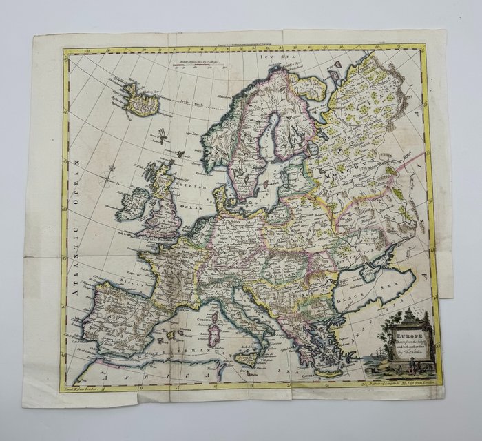
歐洲, 地圖 - 托馬斯·基欽; Thomas Kitchin - Europe drawn from the latest and best authorities - 1761-1780

Detailed English map of Europe and Iceland. Interesting 18th Century map of Europe, colored by countries. Includes decorative cartouche.
Techniques: Copper-plate Engraving
Date/Place: 1770
Printed: London, United Kingdom
Size: 38 cm x 42 cm
Condition: Generally very good with the usual light overall toning, wear, there may be minor imperfections to be expected with age. Minor repaires a tergo.
We include the Certificate of Authenticity. This Item is professionally protected by handmade packing.
編號 83086369
已出售
歐洲, 地圖 - 托馬斯·基欽; Thomas Kitchin - Europe drawn from the latest and best authorities - 1761-1780
Detailed English map of Europe and Iceland. Interesting 18th Century map of Europe, colored by countries. Includes decorative cartouche.
Techniques: Copper-plate Engraving
Date/Place: 1770
Printed: London, United Kingdom
Size: 38 cm x 42 cm
Condition: Generally very good with the usual light overall toning, wear, there may be minor imperfections to be expected with age. Minor repaires a tergo.
We include the Certificate of Authenticity. This Item is professionally protected by handmade packing.
設置搜索提醒
設置搜索提醒,以便在有新匹配可用時收到通知。