Europa, Landkarte - Italien / Sardinien /Malta / Korsika; Christoph Weigel - Insularum Corsicae Sardiniae Melitae Accurata Descriptio ex mente veterum Geographorum - 1701-1720
Nr. 82242121
Nr. 82242121
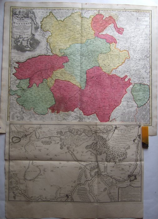
1.) 1720's, XX-Large, very detailed old colored map of Hainaut (also Hennegau, Hennegowen Heynault or Hainault) by the most important German Cartographer of the 18th century - Baptist Homann, at Nuremberg
2.) 1715 dated military map , with positions of French and Imperial Confederate troupes at 24. 7. 1712 ,centered on Denain [French Camp] , by De Fer, at Paris
1.) in good condition, good margins centerfold as usual, little foxing, mostly in outer margins
2.) in good condition , upper left margin [bookbinders outcut] restored , little soiling , folds as issued.
both extremely detailed and very decorative !!
shipping by registered mail only
So kaufen Sie auf Catawiki
1. Etwas Besonderes entdecken
2. Höchstgebot abgeben
3. Sichere Zahlung durchführen