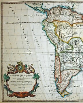
Amerika, Landkarte - Südamerika; Jaillot - Amerique Meridionale - 1719
Nr. 83153599
Nr. 83153599
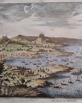
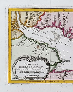
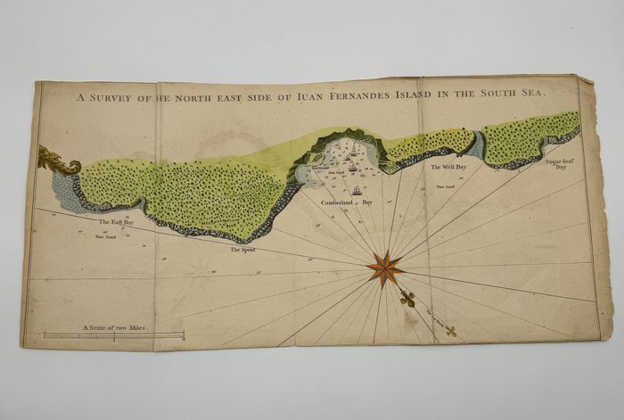
Juan Fernandes Island in the South Sea Chile Anson 1748
A Survey of the North East side of Juan Fernandes Island in the South Sea.
Antique plan of the northeast side of Juan Fernandez Island (Isla Robinson Crusoe), Chile includes vessels, sounding, mile scale and shallows.
In June 1741, Anson's flagship, the Centurion, arrived at Juan Fernandez Island, also known as Robinson Crusoe Island, seeking refuge and replenishing supplies.
The island's lush vegetation, abundant water, and wild goats provided welcome relief for the crew, who had been ravaged by scurvy and other ailments.
George Anson: He was a British naval officer and explorer who led a circumnavigation of the globe from 1740 to 1744.
His voyage resulted in the discovery of several new islands and provided valuable information about the Pacific Ocean.
Anson's maps of his voyage, created by a variety of cartographers, helped to improve the accuracy of geographical knowledge of the region.
Dimensions
28.5 cm x 56 cm
Artist or Maker
George Anson
Medium
Handcolored Copper engraving
Date
1748
Condition Report
The work is in very good to excellent condition overall. Please review the image carefully for condition and contact us with any questions.
This Item is professionally protected by handmade packing. The Certificate of Authenticity is included.
So kaufen Sie auf Catawiki
1. Etwas Besonderes entdecken
2. Höchstgebot abgeben
3. Sichere Zahlung durchführen