16+
Φωτογραφικό άλμπουμ αναμνήσεις της υπηρεσίας μου, 1937-1942, με συνολικά 191 φωτογραφίες. - Στρατιωτική φωτογραφία
Αρ. 81747303
Αρ. 81747303
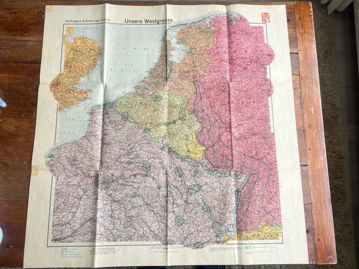
Fantastic period published German map, published by the famous Velhagen & Klalings karte company, famous for their publication of highly detailled German maps during the War. It is dated 1940 in the right corner. The map is nicely detailled and gives a fascinating look into the situation in 1940 prior to the invasion of the lowlands (such as defense lines, air defences, minefield etc). Would be great to frame and display.
100% original item for your German WW2 collection!
See also our other interesting WW2 items that we offer for auction on catawiki!
Πώς να πραγματοποιήσετε αγορές στην Catawiki
1. Ανακαλύψτε κάτι ιδιαίτερο
2. Υποβάλετε την κορυφαία προσφορά
3. Πληρώστε με ασφάλεια