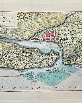
Αμερική, Χάρτης - Βόρεια Αμερική / Ηνωμένες Πολιτείες / Χάρτης του Αγίου Αυγουστίνου / Φλόριντα / λιμάνι; Giuseppe Pazzi & Marco Coltellini - Piano della città e porto di Sant'Agostino - 1761-1780
Αρ. 83261101
Αρ. 83261101
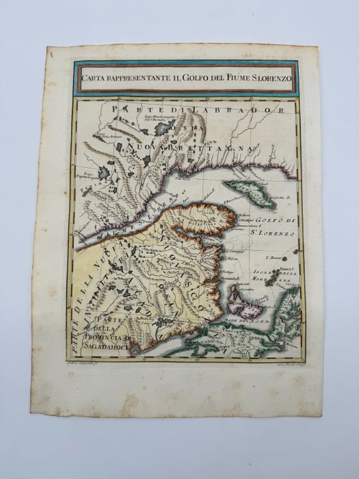
Scarce French and Indian War era map of the area around the entrance to the St. Lawrence River, published in Livorno.
Published shortly after the Treaty of Peace of 1763, the map shows the region bounded by Quebec in the North and Nova Scotia and New Brunswick in the South, with St. Lawerence shown to the Saguenay River.
From M. Coltellini's Il Gazzettiere Americano, 1763.
Title: Carta Rappresentante Il Golfo del Fiume S. Lorenzo
Author: Marco Coltellini
Date: 1763
Medium: Hand-colored copperplate engraving
Condition: Very Good - light age toning and foxing, minor spots across image
Centimeters: 26.5 cm x 20 cm
Condition Report
The work is in very good to excellent condition overall. Please review the image carefully for condition and contact us with any questions.
This Item is professionally protected by handmade packing. The Certificate of Authenticity is included.
Πώς να πραγματοποιήσετε αγορές στην Catawiki
1. Ανακαλύψτε κάτι ιδιαίτερο
2. Υποβάλετε την κορυφαία προσφορά
3. Πληρώστε με ασφάλεια