Der Krieg - 69 X Illustrierte Chronik des Krieges 1914 - 1914-1918
Nr. 83119565
Nr. 83119565
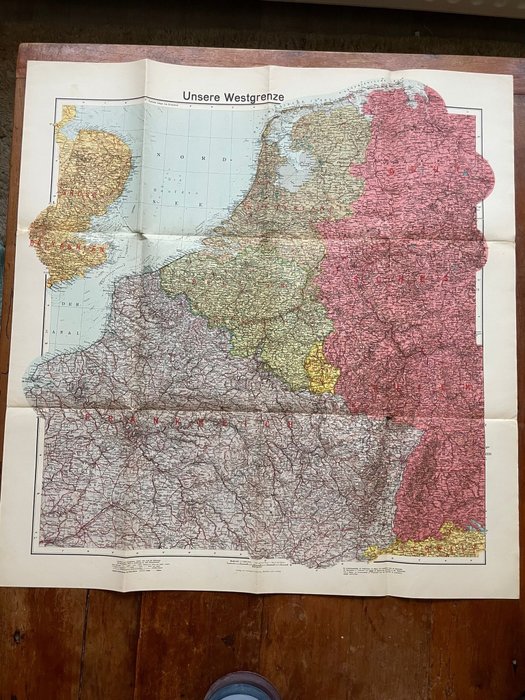
Fantastic period published German map, published by the famous Velhagen & Klalings karte company, famous for their publication of highly detailled German maps during the War. It dates around early 1940. The map is nicely detailled and gives a fascinating look into the situation in 1940 prior to the invasion of the lowlands Would be great to frame and display. In used condition, see photo's as they are part of the description.
100% original item for your German WW2 collection!
See also our other interesting WW2 items that we offer for auction on catawiki!
Zo koop je op Catawiki
1. Ontdek iets bijzonders
2. Plaats het hoogste bod
3. Veilig betalen