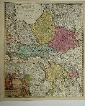
Europa, Kaart - Duitsland / Zwaben / Schwaben / Ulm / Konstanz / Seckingen / Rheinfeld / Waldshut / Lauffenburg /; De Fer - Le Cercle de Souabe, Plan de la Ville d'Ulm, Les quatre Villes Forestiers ... - 1701-1720
Nr. 83745335

Nr. 83745335
1705 dated, by De Fer ,one very detailed map of Switzerland, one military map [Battle near Basle] + 2 sheet with the coats of arms of the 13 Cantons and depending towns and regions . From his 'Atlas Curieux'
in generally fine condition, little soiling ,occasional small tears in margins
shipping by registered mail only
Zo koop je op Catawiki
1. Ontdek iets bijzonders
2. Plaats het hoogste bod
3. Veilig betalen