16+
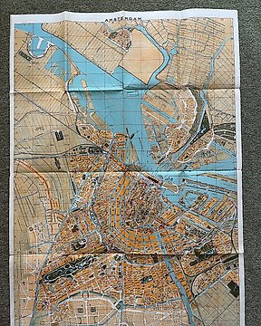
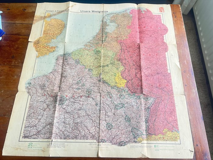
WW2 detaljert oversiktskart over tysk vestfront, Kart - Nederland, Belgia, Frankrike, England - mai - 1940
Nr. 82585445
Nr. 82585445
Fantastic period published German map, published by the famous Velhagen & Klalings karte company, famous for their publication of highly detailled German maps during the War. It is dated 1940 in the right corner. The map is nicely detailled and gives a fascinating look into the situation in 1940 prior to the invasion of the lowlands (such as defense lines, air defences, minefield etc). Would be great to frame and display. In used condition, see photo's as they are part of the description.
100% original item for your German WW2 collection!
See also our other interesting WW2 items that we offer for auction on catawiki!
Hvordan kjøpe på Catawiki
1. Oppdag noe spesielt
2. Legg inn det høyeste budet
3. Å gjøre en sikker betaling