编号 104766206

编号 104766206
IL GRAND TOUR DELLA GRECIA ANTICA: MAPPE, TEMPLI E BATTAGLIE NEL CAPOLAVORO DI BARTHÉLEMY
Questo straordinario atlante illustrato costituisce il complemento iconografico del celebre Voyage du Jeune Anacharsis en Grèce dell’abate Jean-Jacques Barthélemy, una delle opere più influenti dell’Illuminismo europeo. Concepite come supporto visivo al viaggio immaginario del giovane filosofo scita nell’Ellade del IV secolo a.C., le tavole riuniscono carte geografiche, piante urbane, vedute archeologiche, ricostruzioni architettoniche e medaglie antiche, offrendo una vera enciclopedia figurata della civiltà greca. L’opera rappresenta uno dei più ambiziosi tentativi settecenteschi di ricostruzione storica e archeologica dell’antichità classica e contribuì in modo decisivo alla diffusione del gusto neoclassico in Europa.
MARKET VALUE
I volumi di tavole relativi al Voyage du Jeune Anacharsis sono oggi particolarmente ricercati sia dai collezionisti di archeologia classica sia dagli appassionati di cartografia storica. Esemplari completi con le grandi carte ripiegate e le tavole architettoniche originali raggiungono normalmente valori compresi tra €300 e €800, con quotazioni superiori per esemplari conservati in eleganti legature coeve e completi di tutte le incisioni.
PHYSICAL DESCRIPTION AND CONDITION
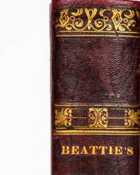
Legatura ottocentesca in mezza pelle con piatti marmorizzati e dorso recante "Voyage du Jeune Anacharsis" e il titolo inglese "PLATES". Ex libris araldico di Benjamin Chapman applicato al contropiatto anteriore. Frontespizio mancante, occhietto presente. Conserva numerose tavole calcografiche ripiegate raffiguranti carte geografiche, piante topografiche, monumenti, templi, teatri, vedute e medaglie dell’antica Grecia. Carte con alcune bruniture fisiologiche e segni del tempo. Nei libri antichi, con una storia plurisecolare, possono essere presenti alcune imperfezioni, non sempre rilevate nella descrizione. Pp. (2); 40; (2).
FULL TITLE AND AUTHOR
Recueil de cartes géographiques, plans, vues et médailles de l’ancienne Grèce.
S.L., [1788-1830].
Jean-Jacques Barthélemy.
CONTEXT AND SIGNIFICANCE
Pubblicato per accompagnare il Voyage du Jeune Anacharsis, questo atlante rappresenta uno dei massimi risultati dell’archeologia erudita del XVIII secolo. Le tavole illustrano con straordinaria precisione i luoghi descritti nel testo: il passaggio delle Termopili, la battaglia di Platea, il Bosforo di Tracia, Atene e l’Attica, Delfi, il Parnaso, il Partenone, i Propilei, i teatri greci e numerosi monumenti dell’antichità. Particolarmente affascinanti sono le grandi carte geografiche pieghevoli e le tavole dedicate alle monete antiche, utilizzate da Barthélemy come fonti storiche per la ricostruzione della Grecia classica. L’opera ebbe enorme successo in tutta Europa e contribuì a formare l’immaginario archeologico e artistico del Neoclassicismo.
BIOGRAPHY OF THE AUTHOR
Jean-Jacques Barthélemy (1716–1795) fu uno dei maggiori archeologi e numismatici francesi del XVIII secolo. Membro dell’Académie Française e custode del Cabinet des Médailles di Parigi, dedicò gran parte della sua vita allo studio delle antichità greche e romane. Il Voyage du Jeune Anacharsis, pubblicato nel 1788, divenne immediatamente un bestseller europeo e rimase per decenni uno dei testi fondamentali per la conoscenza della Grecia antica.
PRINTING HISTORY AND CIRCULATION
Fin dalla prima pubblicazione il Voyage du Jeune Anacharsis fu accompagnato da volumi separati di tavole e carte geografiche. Le edizioni illustrate furono ristampate più volte tra la fine del XVIII e i primi decenni del XIX secolo, rispondendo alla crescente domanda di opere dedicate all’antichità classica. I volumi iconografici venivano spesso acquistati e conservati separatamente dal testo, come atlanti autonomi destinati a biblioteche private e studiosi. L’esemplare qui presentato fu successivamente rilegato per il mercato britannico, come suggerisce il titolo al dorso "PLATES" e la provenienza Chapman.
BIBLIOGRAPHY AND REFERENCES
Barthélemy, Voyage du Jeune Anacharsis en Grèce, Paris, 1788 e successive edizioni.
Brunet, Manuel du Libraire, I, pp. 707–709.
Graesse, Trésor de Livres Rares, I, p. 307.
Quérard, La France Littéraire, I, pp. 210–212.
Cohen-Ricci, Guide de l’amateur de livres à gravures du XVIIIe siècle.
Catalogue général de la Bibliothèque nationale de France, notices relative alle edizioni del Voyage du Jeune Anacharsis.
WorldCat, registrazioni bibliografiche delle varie edizioni del Recueil de cartes géographiques.
ICCU / OPAC SBN, esemplari conservati nelle principali biblioteche italiane.