

America - South America / Argentina / Chile / Strait of Magellan; R de Vaugondy - Les Terres Magellaniques (...) - 1749
No. 77495889
No. 77495889
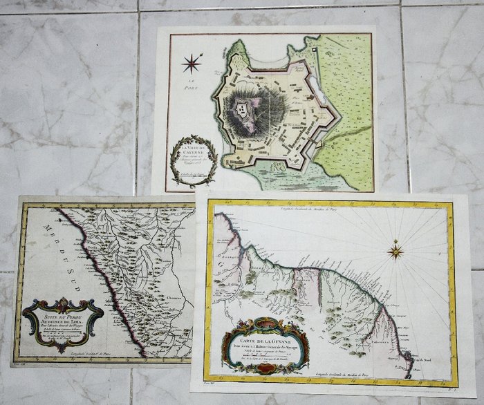
1. Kindoms Guyane Suriname Old Map Carte De La Guyane Bellin 1753
Title: Carte de La Guyane, Pour servir à l'Histoire Générale des VoyagesTiré de la Carte d’Amerique de M. D’Anville.
South America, Fine hand colored map after D’Anville with Missions, Indian villages and rivers.
Artist: Jacques Nicolas Bellin (1703 – 21 March 1772)
Size: 26 x 36 cm. Condition: Very good.
2. Suite du Perou Audience de Lima. Bellin 1756
Titled: Suite du Perou Audience de Lima.
Antique old map of the coast of Peru, including Lima and ancient places.
Mapmaker: Jacques Nicolas Bellin (1703 – 21 March 1772)
Size: 22 x 30.5 cm Condition: Good.
3. La Ville De Cayenne Fort Cépérou French Guiana Bellin 1753
Title: La Ville De Cayenne
Antique plan of the fortified city of Cayenne (Fort Cépérou) French Guiana South America.
The map is copperplate engraved with hand coloring and a decorative title cartouche with wind rose.
The first Europeans arrived in the expeditions of Christopher Columbus, shortly before 1500.
In 1664, France finally succeeded at establishing a permanent settlement at Cayenne.
Cartographer: Jacques Nicolas Bellin.
Size: 33 x 25 cm. Image app.: 27.5 x 22.5 cm. .
Condition: Fine hand colored map in very good condition.
How to buy on Catawiki
1. Discover something special
2. Place the top bid
3. Make a secure payment


