Aasia - Itä-Intian maat / Intia / Thaimaa / Singapore / Laos / Sri Lanka; Bertrand / Lottin / Joly - L'Inde selon les Anciens.... 1798 - 1781-1800
Tsekki - Lunar map; Karel Andel - Original 1926 Lunar Map "Mappa Selenographica" (Brown Edition, WWII German Archive) + 1 Reprint - 1921-1950
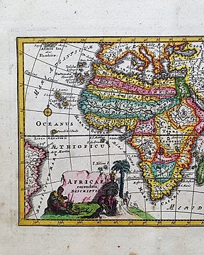
Afrikka - Madagaskar / Kongon demokraattinen tasavalta / Guinea / Somalia / Senegal / Eritrea; Christopher Weigel & David Kohler - Africae Emendata Descriptio - 1701-1720
Tsekki - Taivaallinen (Kuu ja Mars); Antonín Rükl & Pavel Příhoda (Incl. TRUE 1st Editions 1999/2000 & Vintage 1970s) - Antonín Rükl & Pavel Příhoda (Incl. TRUE 1st Editions 1999/2000 & Vintage 1970s) - 1981-1900
Intia - Intia, Bengal; Society for the Diffusion of Useful Knowledge - India, Bengal Presidency 1831 - 1821-1850
Intia - Pohjois-Intia, Nepalin kanssa, Allahabad ja Himalajat; Society for the Diffusion of Useful Knowledge - India X - 1821-1850
Middle East - Ottomaanien hallitsema Suuri Palestiina (osia Libanonista ja Syyriasta) sekä Jerusalemin sisäkuva; William Hughes - Palestine with the Hauran and the Adjacent Districts - 1851-1860
Celestial Map - Kronologinen kartta / Maailmankartta / Zodiakki; Moutard - Delaporte - Hemisphere Septentrional & Hemisphere Meridional - 1721-1750
Tsekki - Lunar map; Karel Andel - Lunar Map "Mappa Selenographica" (WWII German Military Archive Provenance) - 1921-1950
Intia - Pohjois-keski- ja itäiset alueet, erityisesti näyttäen Punjabia, Kashmir (Kashmir), Lahorea, ja; Society for the Diffusion of Useful Knowledge - India XI - 1821-1850
Intia - Pohjois-Intia, Nepal ja Kabul 1817; John Thomson - British India, northern part w/ Nepal & Cabul - 1801-1820
Japani - Japani; 大日本雄弁会講談社 キング - Detailed China Map and Manchuria Soviet Border Map 1938 Pre War Japan Kodansha - 1938
World-Celestial Maps - La Luna / Kuu / Taivaankartta; A. Stieler / G.J. Perthes - (1871) - Die Sichtbare seite der Mond-Oberflache, 1871 - 1861-1880
Pohjois-Amerikka - Pohjois- ja Etelä-Amerikka / Kanada / Yhdysvallat / Meksiko; G. Delisle / P. Buache - Carte d'Amerique, 1765 - 1761-1780
Afrikka - Egypti / Niili / Kairo / Pyramidit; S. Münster - Warhaffte abcontrasehtung der mechtigen und desten Statt Alcair - 1581-1600
Aasia - Asa Minor / Lähi-itä / Iran / Persia / Kaspianmeri; Bertrand / Lottin / Joly - Carte de la Perse...... 1798 - 1781-1800
Aasia - Lähi-itä / Pieni-Aasia / Arabia / Iran / Qatar; C. Delamarche & R. de Vaugondy - Turquie d'Asie, Arabie, Perse, Tartarie Independante - 1761-1780