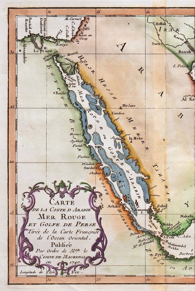
Middle East - Saudi Arabia Yemen Oman United Arab Emirates Qatar Red Sea; N. Bellin - Carte de la Coste d'Arabie, Mer Rouge et Golfe de Perse - 1751-1760

06
giorni
15
ore
02
minuti
27
secondi
Offerta attuale
€ 1
Nessun prezzo di riserva
Ilaria Colombo
Esperto
Selezionato da Ilaria Colombo

Specialista in libri antichi, con focus sulle dispute teologiche dal 1999.

Stima  € 110 - € 170
7 persone stanno guardando questo oggetto
itOfferente 7288 1 €

Tutela degli acquirenti Catawiki

Il tuo pagamento è al sicuro con noi finché non ricevi il tuo oggetto.Mostra dettagli

Trustpilot 4.4 | 121798 recensioni

Valutato Eccellente su Trustpilot.

Carta Carte de la Coste d'Arabie, Mer Rouge et Golfe de Perse, incisione in rame di N. Bellin, pubblicata da Didot a Parigi, che copre il Medio Oriente includendo Arabia Saudita, Yemen, Oman, Emirati Arabi Uniti, Qatar e Mar Rosso, dimensioni 25 x 34 cm.

Riepilogo creato con l’aiuto dell’IA

Descrizione del venditore

Dimensions: 22 x 25 cm. (on sheet: 25 x 34 cm.).

Condition: very good
Verso: blank.

Author: Antoine Francois Prevost
Mapmaker: N. Bellin
Publisher: Didot. Paris.
Note: from "Histoire generale des Voyages ou nouvelle collection de toutes les relations de voyages"

Jacques-Nicolas Bellin (1703-1772) was among the most important mapmakers of the eighteenth century. In 1721, at only the age of 18, he was appointed Hydrographer to the French Navy. In August 1741, he became the first Ingénieur de la Marine of the Dépôt des cartes et plans de la Marine. Bellin set a very high standard of workmanship and accuracy, cementing France's leading role in European cartography and geography during this period. Many of his maps were copied by other mapmakers across the continent.

Dettagli

Epoca
1400-1900
Numero di articoli
1
Paese
Middle East
Specificazione geografica
Saudi Arabia, Yemen, Oman, United Arab Emirates, Qatar, Red Sea.
Creatore mappa / Editore
N. Bellin
Titolo mappa / libro
Carte de la Coste d'Arabie, Mer Rouge et Golfe de Perse
Periodo
1751-1760
Condizione
Eccellenti
Tecnica
Incisione in rame
Serie
Original antique copper engraving
Colore della mappa
Colorazione a mano successiva
Altezza
25 cm
Larghezza
34 cm
Venduto da
ItaliaVerificato
4325
Oggetti venduti
100%
protop

Oggetti simili

Per te in

Mappe