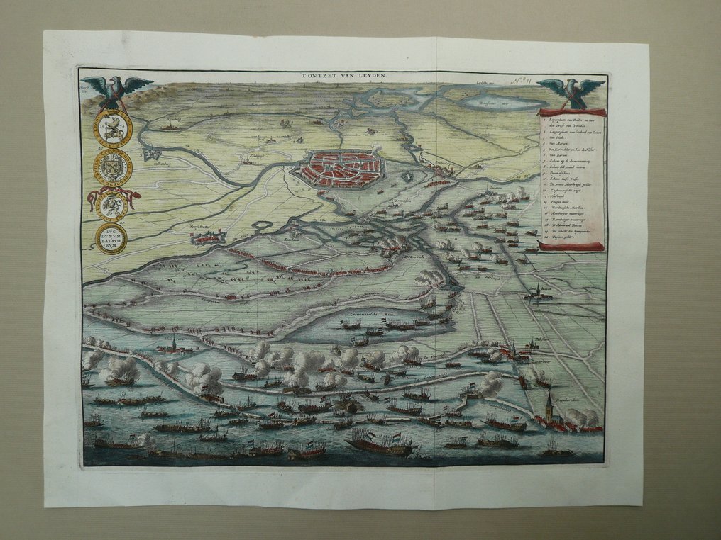
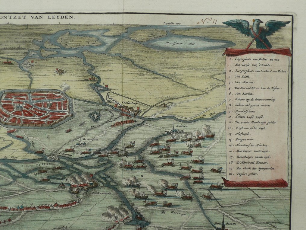
Netherlands - Leiden / Zoetermeer / Voorschoten / Leiderdorp / Zoeterwoude; Jan Luyken - 'T Ontzet van Leyden - 1721-1750

06
days
00
hours
46
minutes
02
seconds
Current bid
€ 5
No reserve price
5 other people are watching this object
nlBidder 7049 €5
nlBidder 8977 €4
nlBidder 7049 €3

Catawiki Buyer Protection

Your payment’s safe with us until you receive your object.View details

Trustpilot 4.4 | 122713 reviews

Rated Excellent on Trustpilot.

Dutch copper-engraved map by Jan Luyken titled 'T Ontzet van Leyden', covering Leiden, Zoetermeer, Voorschoten, Leiderdorp and Zoeterwoude.

AI-assisted summary

Description from the seller

Sheet: 32 x 40 cm.
Copper engraving published in Jean Le Clerc: Histories of the United Netherlands, from the beginning of the Republic until the Treaty of Utrecht in the year 1713, ... Amsterdam, Zacharias Chatelain, Bookseller at the Dam, 1730. Folded as issued.

Insured shipment

Sheet: 32 x 40 cm.
Copper engraving published in Jean Le Clerc: Histories of the United Netherlands, from the beginning of the Republic until the Treaty of Utrecht in the year 1713, ... Amsterdam, Zacharias Chatelain, Bookseller at the Dam, 1730. Folded as issued.

Insured shipment

Details

Era
1400-1900
Country
Netherlands
Geographical specification
Leiden / Zoetermeer / Voorschoten / Leiderdorp / Zoeterwoude
Map maker/ publisher
Jan Luyken
Map/ Book title
'T Ontzet van Leyden
Period
1721-1750
Condition
Excellent
Technique
Copper engraving
Additional Information
18th century engraving depicting the siege of Leiden.
Map colour
Contemporary hand colour
Height
32 cm
Width
40 cm
Sold by
The NetherlandsVerified
24917
Objects sold
100%
protop

Similar objects

For you in

Maps