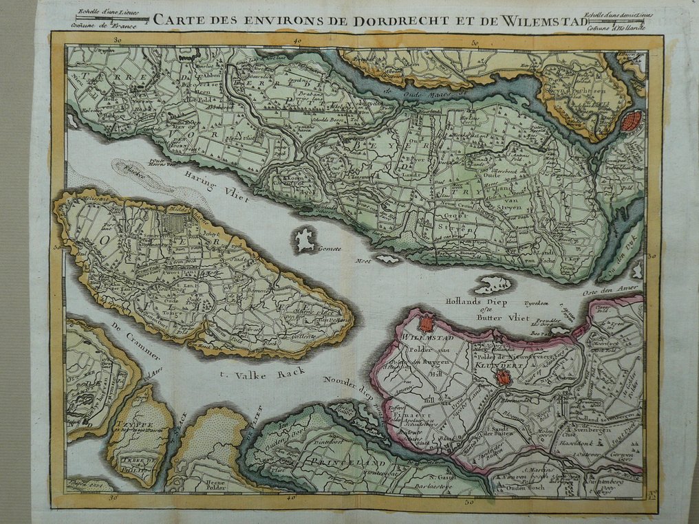
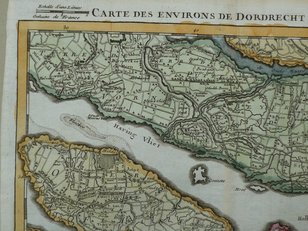
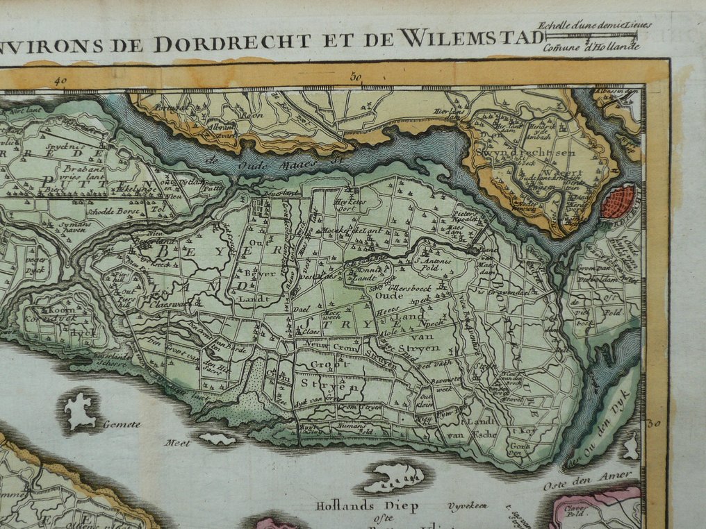
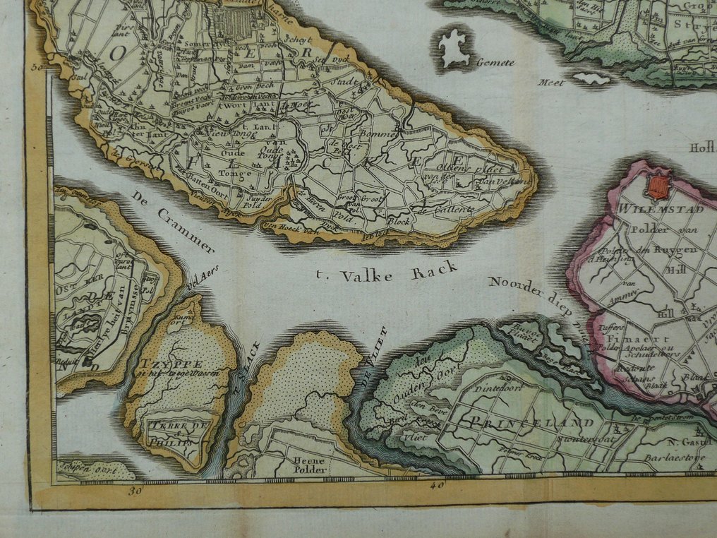
Belgium - Zuid Holland / Dordrecht / Willemstad; J.B. Crepy - Carte des environs de Dordrecht et de Willemstad - 1721-1750

04
days
17
hours
55
minutes
10
seconds
Starting bid
€ 1
No reserve price
No bids placed

Catawiki Buyer Protection

Your payment’s safe with us until you receive your object.View details

Trustpilot 4.4 | 122813 reviews

Rated Excellent on Trustpilot.

Copper-engraved map titled Carte des environs de Dordrecht et de Willemstad, published in Paris by J.B. Crepy in 1748, hand coloured in the period, showing Zuid Holland / Dordrecht / Willemstad, 21 × 26 cm, in excellent condition, folded as issued.

AI-assisted summary

Description from the seller

Copper engraving appeared in; County of Holland, Lordship of Utrecht, County of Zeeland, Zutphen, and Duchy of Brabant. In Paris at Crepy. 1748.
Fold as issued.

Insured shipment

Copper engraving appeared in; County of Holland, Lordship of Utrecht, County of Zeeland, Zutphen, and Duchy of Brabant. In Paris at Crepy. 1748.
Fold as issued.

Insured shipment

Details

Era
1400-1900
Country
Belgium
Geographical specification
Zuid Holland / Dordrecht / Willemstad
Map maker/ publisher
J.B. Crepy
Map/ Book title
Carte des environs de Dordrecht et de Willemstad
Period
1721-1750
Condition
Excellent
Technique
Copper engraving
Additional Information
Rare 18th-century map
Map colour
Contemporary hand colour
Height
21 cm
Width
26 cm
Sold by
The NetherlandsVerified
24926
Objects sold
100%
protop

Similar objects

For you in

Maps