Europe - European Empire / Mediterranean Countries; Matthaus Seutter / C. Lotter - Europae - 1721-1750


04
days
22
hours
03
minutes
16
seconds

No bids placed
Catawiki Buyer Protection
Your payment’s safe with us until you receive your object.View details
Trustpilot 4.4 | 122813 reviews
Rated Excellent on Trustpilot.
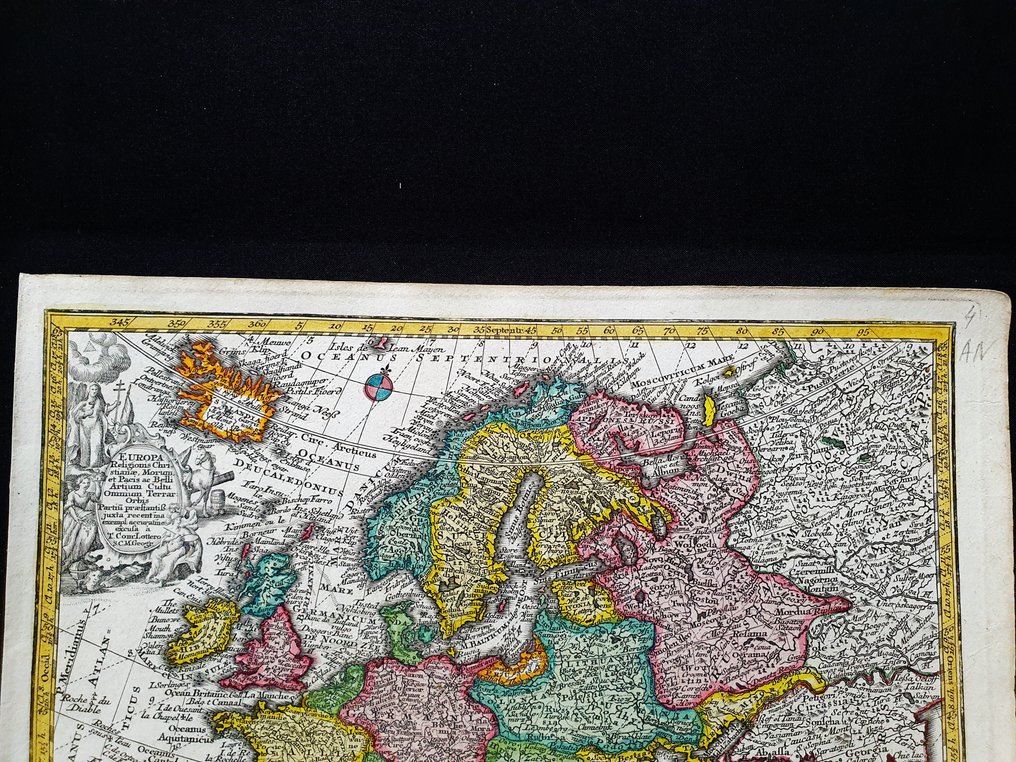
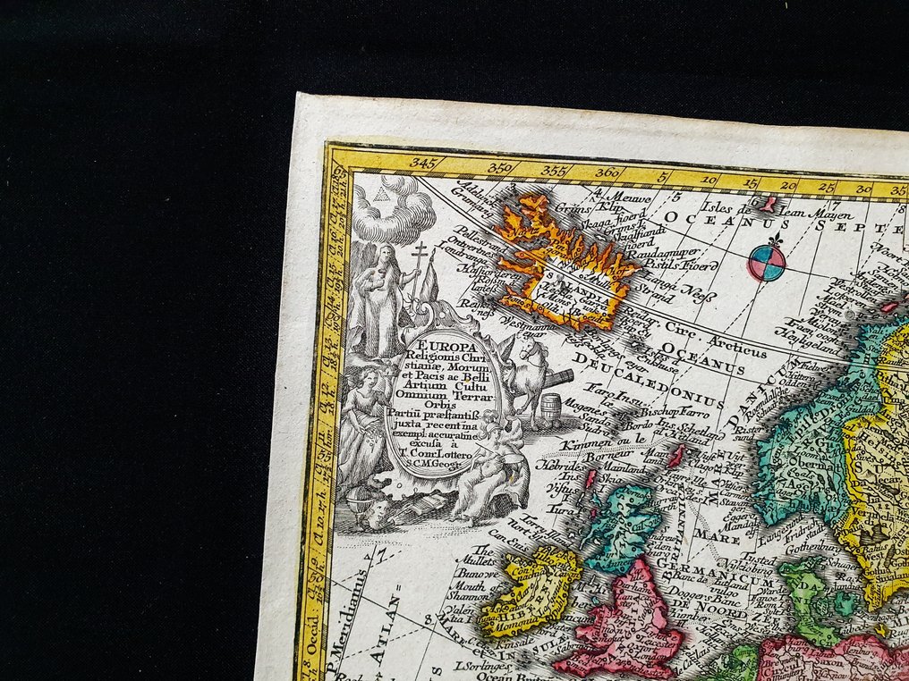
Europae, an original copperplate map by Matthaus Seutter with C. Lotter, circa 1720, hand-coloured at the time, copper-engraved, 29 by 22 cm, depicting the European Empire and Mediterranean countries.
AI-assisted summary
Description from the seller
This rare geographic map is an original copper engraving from around 1720.
This is the very rare pocket edition by MATTHAUS SEUTTER, published in 1720, in his Atlas which bears the name of: "ATLAS MINOR - Atlas novus sive Tabulae geographicae totius Orbis faciem, partes, imperia, regna et provinciales exhibentes exactissima cura iuxta recent observationae Matthaeus Seutter-Grosser Atlas worinnen enthalten alle jenige geographische Universal Special und Particular-Mappen......AUGSBURG, 1720"
Beautiful map published in Germany, with excellent and original watercolour work, wide margins and geographically well detailed at every point.
Conditions: the conditions are truly more than good, as shown in the photo.
The overall measurements of the map are: 29 cm x 22 cm.
Seller's Story
I am a private Catawiki seller and I sell collectibles, a wonderful world.
Translated by Google TranslateThis rare geographic map is an original copper engraving from around 1720.
This is the very rare pocket edition by MATTHAUS SEUTTER, published in 1720, in his Atlas which bears the name of: "ATLAS MINOR - Atlas novus sive Tabulae geographicae totius Orbis faciem, partes, imperia, regna et provinciales exhibentes exactissima cura iuxta recent observationae Matthaeus Seutter-Grosser Atlas worinnen enthalten alle jenige geographische Universal Special und Particular-Mappen......AUGSBURG, 1720"
Beautiful map published in Germany, with excellent and original watercolour work, wide margins and geographically well detailed at every point.
Conditions: the conditions are truly more than good, as shown in the photo.
The overall measurements of the map are: 29 cm x 22 cm.
Seller's Story
I am a private Catawiki seller and I sell collectibles, a wonderful world.
Translated by Google TranslateDetails
Era
1400-1900
Number of items
1
Country
Europe
Geographical specification
European Empire / Mediterranean Countries
Map maker/ publisher
Matthaus Seutter / C. Lotter
Designer/Artist/Maker
Matthaus Seutter
Map/ Book title
Europae
Period
1721-1750
Condition
Excellent
Technique
Copper engraving
Additional Information
Original colored copper plate
Map colour
Contemporary hand colour
Height
29 cm
Width
22 cm
Sold by
