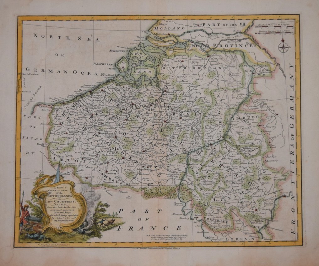
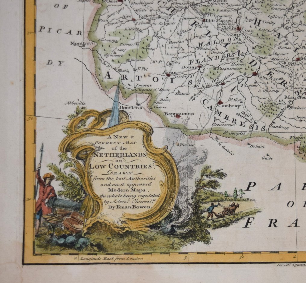
Belgium - Belgium; Emanuel Bowen - A NEW & CORRECT MAP OF THE NETHERLANDS OR LOW COUNTRIES BY E. BOWEN - 1721-1750

04
days
17
hours
00
minutes
04
seconds

3 other people are watching this object
 Bidder 4166 Bidder 4166 | €2 | |
|---|---|---|
 Bidder 4133 Bidder 4133 | €1 |
Catawiki Buyer Protection
Your payment’s safe with us until you receive your object.View details
Trustpilot 4.4 | 122813 reviews
Rated Excellent on Trustpilot.
A NEW & CORRECT MAP OF THE NETHERLANDS OR LOW COUNTRIES by Emanuel Bowen, a copper engraving of Belgium with later hand colouring, measuring 340 by 420 mm and in excellent condition.
AI-assisted summary
Description from the seller
A NEW & CORRECT MAP OF THE NETHERLANDS OR LOW COUNTRIES.
An attractive copper line engraving on paper by Emanuel Bowen, produced to accompany Mr Tindal's Continuation of Mr Rapin's History of England, circa 1745.
Measures 340 x 420 mm. Nice example. See photo for condition.
Attractive hand colour.
A guaranteed genuine antique map.
EMANUEL BOWEN
Emanuel Bowen (1694 – 8 May 1767) was a Welsh map engraver, who achieved the unique
distinction of becoming Royal Mapmaker to both to King George II of Great Britain and Louis XV
of France . Bowen was highly regarded by his contemporaries for producing some of the largest,
most detailed and most accurate maps of his era. He is known to have worked with most British
cartographic figures of the period including John Owen and Herman Moll . Bowen was born at
Tal-y-Llychau (now Talley ), Carmarthenshire , Wales . His father was Owen
Bowen, a prominent member of the local gentry ("a distinguished but not noble gentleman”). In
1709, Emanuel Bowen was apprenticed as a merchant tailor to Charles Price.
Bowen worked in London from 1714 and was admitted to the Merchant Taylors Livery Company
on 3 October 1716.One of his earliest engraved works, Britannia Depicta , published in 1720,
contained over two hundred road maps together with a miniature county map of each of the counties
of England and Wales. It followed on John Ogilby's earlier work with updated style of historical and
heraldic detail. It was an unusual feature of the atlas that the maps were engraved on both sides of
each page, resulting in a handier-sized book. By 1726 he was noted as one of the leading London
engravers. Among his multiple apprentices, the most notable were Thomas Kitchin , Thomas
Jeffreys and John Lodge. Another apprentice, John Oakman who had an affair with and eventually
married, Bowen's daughter. Other Bowen apprentices include Thomas Buss, John Pryer, Samuel
Lyne, William Fowler and his own son Thomas Bowen . He published A Complete System of
Geography, 1744–7; an English Atlas, with a new set of maps, 1745(?); a Complete Atlas ... in
sixty-eight Maps,1752; Atlas Minimus; or a new set of Pocket Maps,1758; and a series of
separate maps of the English counties, of Germany, Asia Minor, and Persia, between 1736 and
1776. A recurring feature of Bowen's work, evident even on the early road maps, was his habit of
filling every corner and space of the map with jottings and footnotes, both historical and
topographical.
In spite of his royal patronage and renown, Bowen like many cartographers of his day, would die in
poverty. His son, Thomas Bowen (1733–1790) would carry on the business, but would ultimately
suffer a similar fate, dying in a Clerkenwell workhouse in 1790.
Details
Era
1400-1900
Country
Belgium
Geographical specification
Belgium
Map maker/ publisher
Emanuel Bowen
Map/ Book title
A NEW & CORRECT MAP OF THE NETHERLANDS OR LOW COUNTRIES BY E. BOWEN
Period
1721-1750
Condition
Excellent
Technique
Copper engraving
Additional Information
A detailed and decorative map of Belgium
Map colour
Later hand colour
Height
340 mm
Width
420 mm
Sold by
