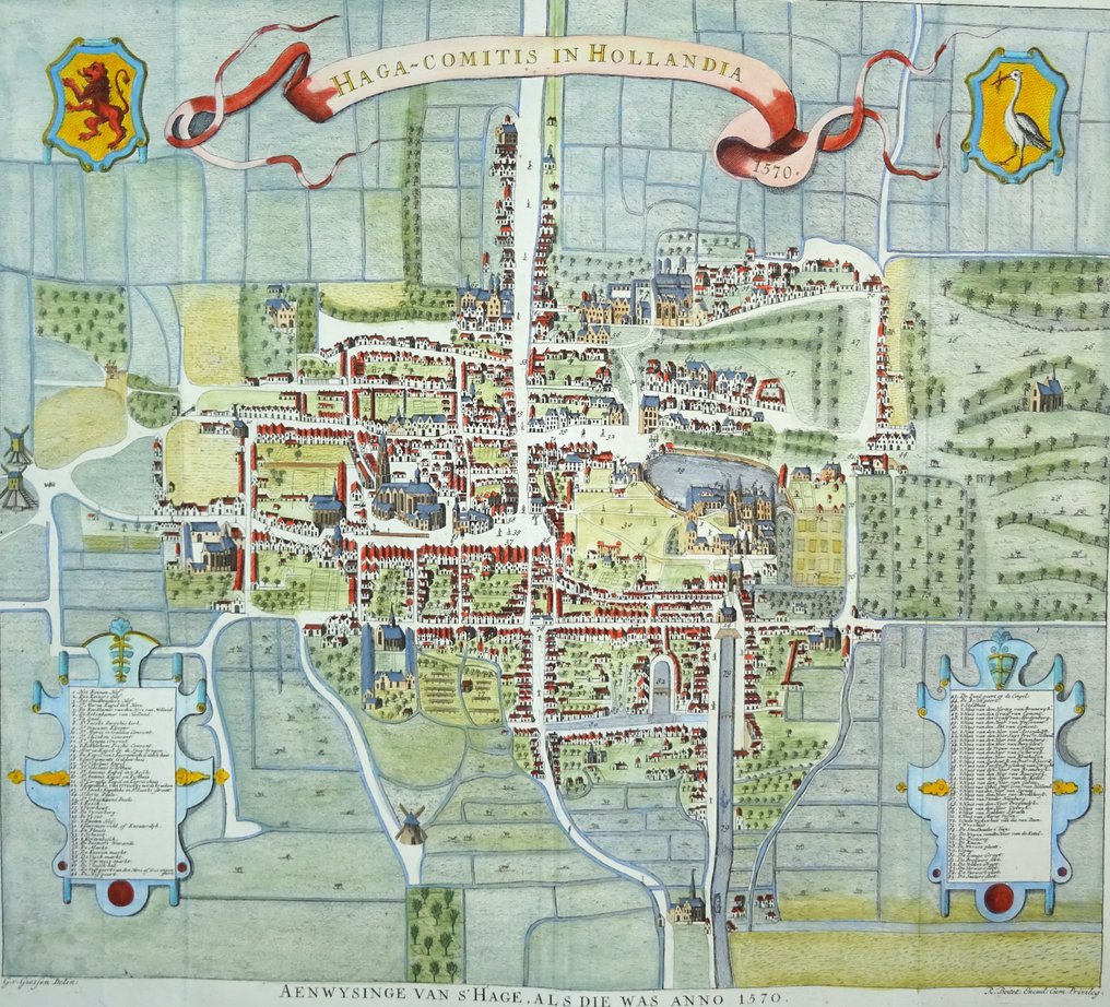
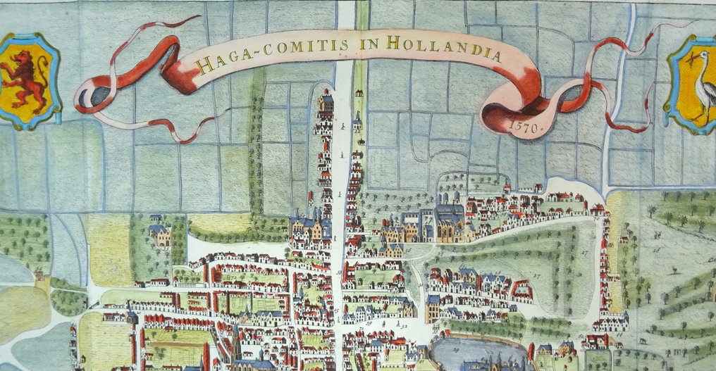
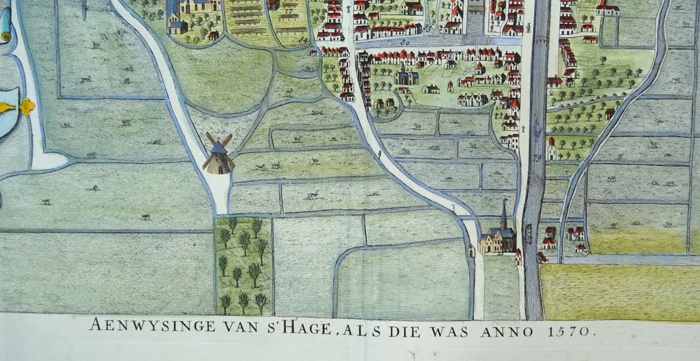
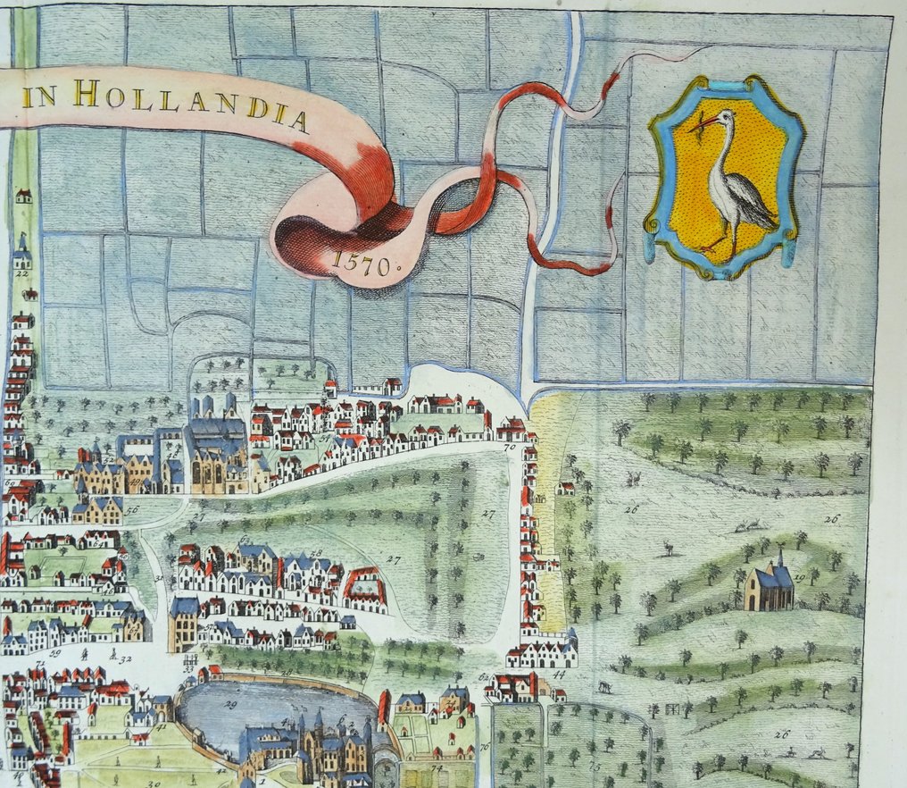
Netherlands - The Hague; Reinier Boitet - Haga-Comitis in Hollandia 1570 / Aenwysinge van ´s Hage, als die was anno 1570 - 1721-1750

Opens 11:00
Starting bid
€ 1

Add to your favourites to get an alert when the auction starts.

Ilaria Colombo
Expert
Selected by Ilaria Colombo

Specialist in old books, specialising in theological disputes since 1999.

Estimate  € 350 - € 600
Catawiki Buyer Protection

Your payment’s safe with us until you receive your object.View details

Trustpilot 4.4 | 122813 reviews

Rated Excellent on Trustpilot.

Description from the seller

Haga-Comitis in Holland in 1570 / Indication of The Hague, as it was in 1570 (1730).

Folio size and very beautifully engraved 18th-century city map of The Hague, as it must have been around 1570. This map of The Hague is a work based on an anonymous original of an earlier date, which is owned by the Municipality of The Hague. This version dates from 1730 and was created by Gerrit van der Giessen on behalf of Jacob de Riemer.

The plate is from: 'Description of The Hague,' by Mr. Jacob Riemer (1676-1762), published in Delft by Reinier Boitet, 1730.

The book contains many beautiful engravings of important buildings, churches, monasteries, estates, and castles of The Hague.

The plates are engraved by Gerrit van Giesen (1692-1750), Jan Caspar Phillips (1700-1765), and F. v. Bleyswyck. Published by Reinier Boitet (1680-1750).

Image 45x50cm, sheet 50x56.5cm

Good to very good condition, very thick paper, and very clear print. Some minor repairs/reinforcements at the crossing of a few folds with very limited impact on the image (see image). Otherwise excellent. Folds as published.

Details

Era
1400-1900
Number of items
1
Country
Netherlands
Geographical specification
The Hague
Map maker/ publisher
Reinier Boitet
Map/ Book title
Haga-Comitis in Hollandia 1570 / Aenwysinge van ´s Hage, als die was anno 1570
Period
1721-1750
Condition
Good
Technique
Copper engraving
Additional Information
Folio size, very beautifully engraved 18th-century map of The Hague as it was in 1570.
Map colour
Later hand colour
Height
50 cm
Width
56.5 cm
Sold by
SpainVerified
4705
Objects sold
100%
protop

Similar objects

For you in

Maps