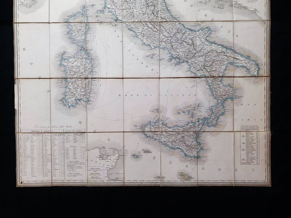
Europe - Italy / Sardinia / Sicily / Lombardy / Puglia / Lazio / Venice / Rome; T. Genevresi / F. Naymiller / G. Prada - Carta Geografica dell'Italia - 1821-1850

03
days
06
hours
28
minutes
48
seconds
Current bid
€ 80
Reserve price not met
Ilaria Colombo
Expert
Selected by Ilaria Colombo

Specialist in old books, specialising in theological disputes since 1999.

Estimate  € 300 - € 500
24 other people are watching this object
itBidder 6539 €80
itBidder 6539 €75
itBidder 6539 €50

Catawiki Buyer Protection

Your payment’s safe with us until you receive your object.View details

Trustpilot 4.4 | 123878 reviews

Rated Excellent on Trustpilot.

Carta Geografica dell'Italia, a large copper-engraved wall map printed in Italy (Milano) circa 1865 by T. Genevresi, F. Naymiller and G. Prada, illustrating Italy with Sardinia, Sicily, Lombardy, Apulia, Lazio, Venice and Rome; about 117 × 90 cm, hand-coloured contemporarily, four sheets mounted on linen, a scarce and very rare map in excellent condition.

AI-assisted summary

Description from the seller

This wall map is a very large engraving on original copper (a WALL-MAP...) published in its updated edition around 1865.

This is a rare map, engraved on four large sheets and joined together on an antique mounted sheet of 42 sections, forming the Italy interior; the map was published in Italy, in Milan, by the publisher Tomaso Genevresi, and is presented here in its rare updated edition, where, as already mentioned, it is antique mounted on a white linen canvas and divided into no less than 42 sections across the entire total sheet.

The work presented is absolutely very rare to find, mainly in this updated edition and especially in its completeness.


Conditions: The conditions of this mesh map are very good, as shown in the photo, especially considering its enormous size; however, there may be small signs of very light blooming scattered around, as well as some harmless old cuts and/or holes in the side areas.

The overall and total measurements of the map are approximately: Cm 117 X 90.

Seller's Story

I am a private Catawiki seller and I sell collectibles, a wonderful world.
Translated by Google Translate

Details

Era
1400-1900
Number of items
1
Country
Europe
Geographical specification
Italy / Sardinia / Sicily / Lombardy / Puglia / Lazio / Venice / Rome
Map maker/ publisher
T. Genevresi / F. Naymiller / G. Prada
Map/ Book title
Carta Geografica dell'Italia
Period
1821-1850
Condition
Excellent
Technique
Copper engraving
Additional Information
Scarce and very rare "Big Wall Map" of Italy
Map colour
Contemporary hand colour
Height
117 cm
Width
90 cm
ItalyVerified
8468
Objects sold
100%
Privatetop

Similar objects

For you in

Maps