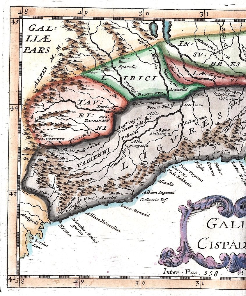
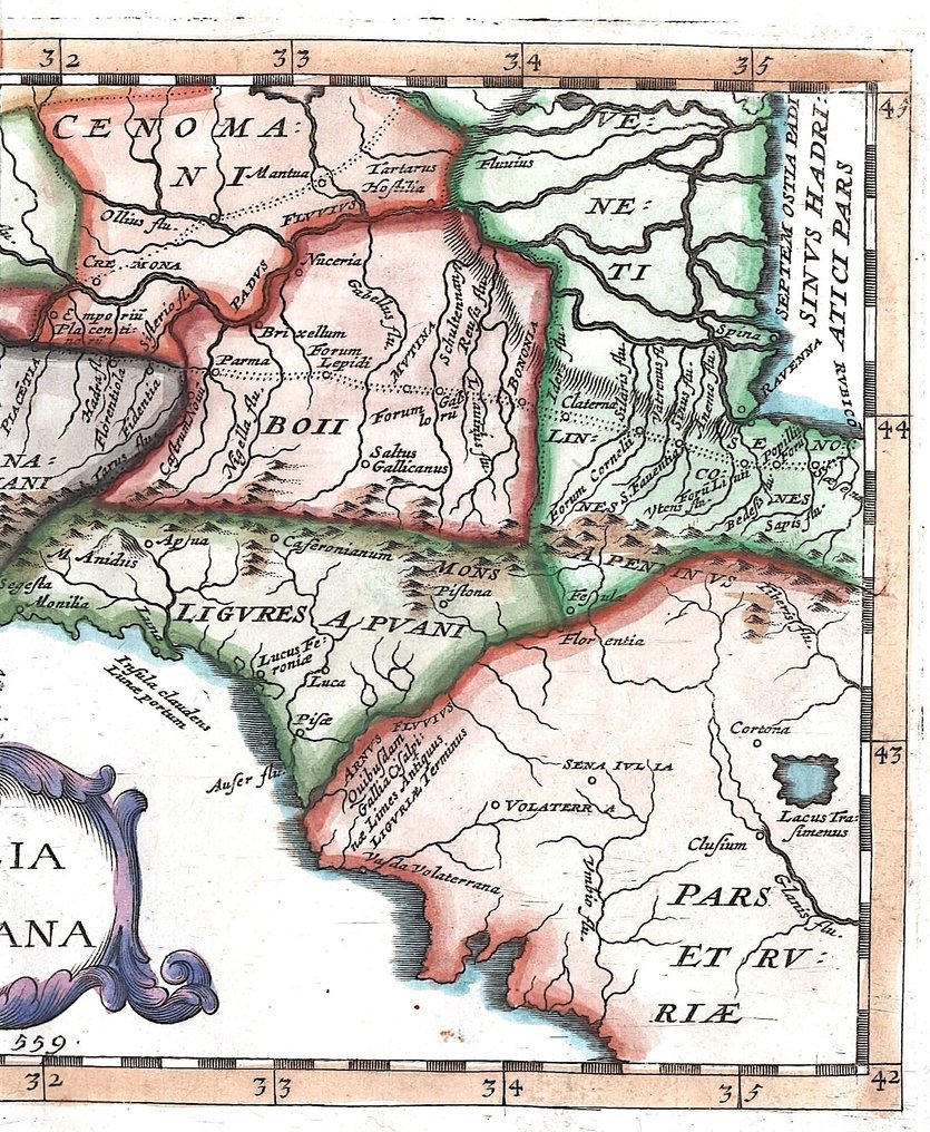
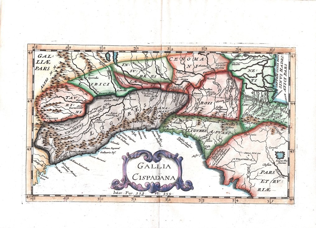
Italy - Piedmont, Tuscany, Emilia Romagna, Liguria; P. Briet - Gallia Cispadana - 1649

05
days
08
hours
39
minutes
53
seconds
Current bid
€ 54
No reserve price
12 other people are watching this object
itBidder 0505 €54
itBidder 2182 €49
itBidder 6262 €40

Catawiki Buyer Protection

Your payment’s safe with us until you receive your object.View details

Trustpilot 4.4 | 123718 reviews

Rated Excellent on Trustpilot.

Copper engraving map Gallia Cispadana by P. Briet, published by Cramoisy in Paris, Italy including Piedmont, Tuscany, Emilia Romagna and Liguria, dating to 1649 with later hand colour, sheet size 23 × 30.5 cm, in excellent condition.

AI-assisted summary

Description from the seller

Dimensions: 17 x 25 cm. (on sheet: 23 x 30,5 cm)

Condition: Very good
Verso: blank.

Mapmaker: P. Briet
Publisher: Cramoisy. Paris.
Note: from "Parallela geographica Italiae veteris et novae...."


Dimensions: 17 x 25 cm. (on sheet: 23 x 30,5 cm)

Condition: Very good
Verso: blank.

Mapmaker: P. Briet
Publisher: Cramoisy. Paris.
Note: from "Parallela geographica Italiae veteris et novae...."


Details

Era
1400-1900
Over 200 years old
Yes
Number of items
1
Country
Italy
Geographical specification
Piedmont, Tuscany, Emilia Romagna, Liguria
Map maker/ publisher
P. Briet
Map/ Book title
Gallia Cispadana
Period
1649
Condition
Excellent
Technique
Copper engraving
Additional Information
Original Antique Copper Engraving
Map colour
Later hand colour
Height
23 cm
Width
30.5 cm
Sold by
ItalyVerified
4455
Objects sold
100%
protop

Similar objects

For you in

Maps