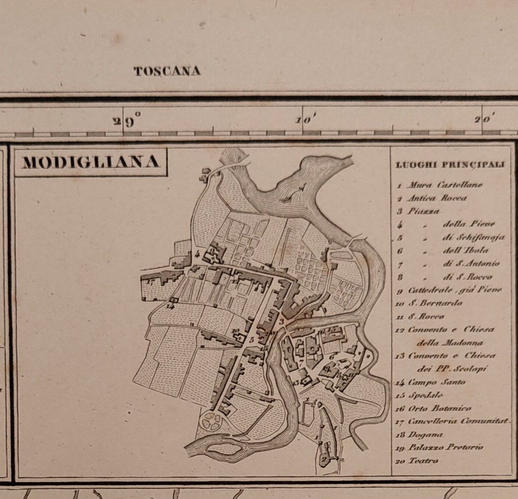
Italy - Tuscany; Antonio Vallardi - Provincia di FIRENZE - 1881-1900

09
days
01
hour
52
minutes
35
seconds
Current bid
€ 35
No reserve price
14 other people are watching this object
itBidder 4324 €35
plBidder 4461 €30
itBidder 4324 €30

Catawiki Buyer Protection

Your payment’s safe with us until you receive your object.View details

Trustpilot 4.4 | 123951 reviews

Rated Excellent on Trustpilot.

Provincia di FIRENZE, an acero-engraved map by Antonio Vallardi, published in Italia in 1895, covers the Toscana region at 59 by 42 cm with hand-coloured territorial borders and full altimetric references.

AI-assisted summary

Description from the seller

Province of Florence

From: Golden hydrographic, chorographic, and historical atlas of Italy
Publishing House Dr. FRANCESCO VALLARDI, Corso Magenta, 48 - Milan 1895

Wide, detailed map of the Florentine territory, complete with altitude references, scales in miles and kilometers; it is complemented by six maps of Tuscan towns orbiting the Tuscan capital: from left to right, we have San Miniato, Modigliana, Volterra, Pistoia, Prato, and Pescia.

Engraving in burr steel on 19th-century paper, blank back, wide margins, slight browning especially on the edges, contemporaneous coloring of the territorial boundaries.

Dimensions: 59x42 cm

Seller's Story

I am a restorator and classical philologist, owner of a shop located at Piazza Farnese specializing in ancient cartography: rare maps and views, nautical charts, health permits, curiosities...
Translated by Google Translate

Details

Era
1400-1900
Number of items
1
Country
Italy
Geographical specification
Tuscany
Map maker/ publisher
Antonio Vallardi
Map/ Book title
Provincia di FIRENZE
Period
1881-1900
Condition
Excellent
Technique
Steel engraving
Additional Information
1895
Map colour
Contemporary hand colour
Height
59 cm
Width
42 cm
ItalyVerified
552
Objects sold
100%
pro

Similar objects

For you in

Maps