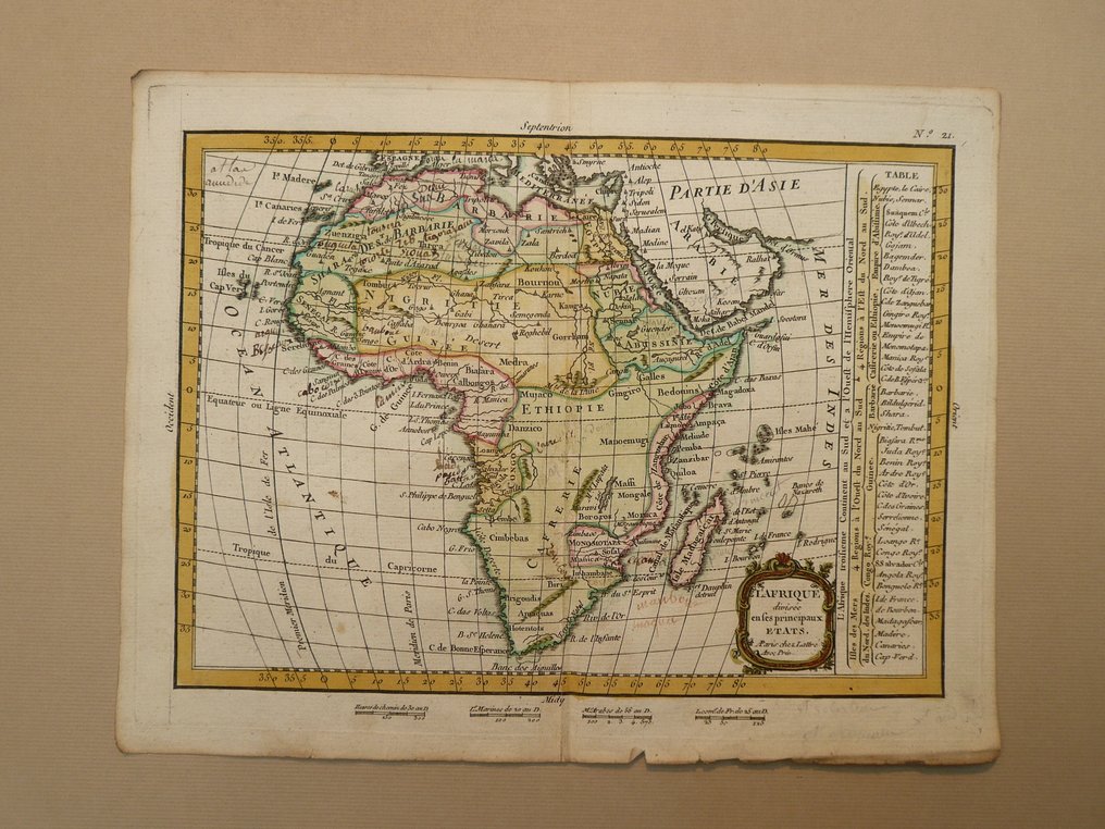
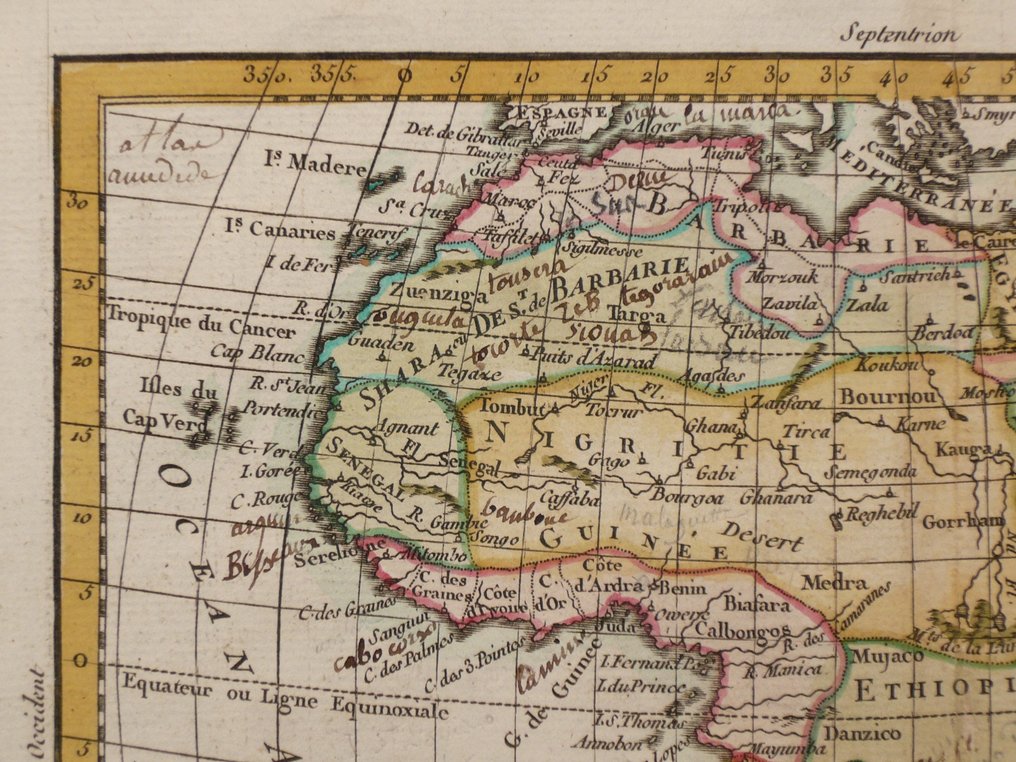
Africa - Madagascar; Jean Lattré - L'Afrique - 1781-1800

03
days
23
hours
58
minutes
47
seconds
Current bid
€ 2
No reserve price
Volker Riepenhausen
Expert
Selected by Volker Riepenhausen

Specialist in travel literature and pre-1600 rare prints with 28 years experience.

Estimate  € 170 - € 200
15 other people are watching this object
beBidder 2717 €2
atBidder 5875 €1

Catawiki Buyer Protection

Your payment’s safe with us until you receive your object.View details

Trustpilot 4.4 | 123759 reviews

Rated Excellent on Trustpilot.

L'Afrique, a copper-engraved map by Jean Lattré, published in Paris in 1789, measuring 18 x 25 cm with contemporary hand colour, from the 18th century and detailing Madagascar in Africa.

AI-assisted summary

Description from the seller

18 x 25 cm.
Copperengraving published in; "Petit Atlas Moderne ou Collection de Cartes Elementaires". Jean Lattré. Paris 1789.
Centrefold as published.

Insured shipment

18 x 25 cm.
Copperengraving published in; "Petit Atlas Moderne ou Collection de Cartes Elementaires". Jean Lattré. Paris 1789.
Centrefold as published.

Insured shipment

Details

Era
1400-1900
Country
Africa
Geographical specification
Madagascar
Map maker/ publisher
Jean Lattré
Map/ Book title
L'Afrique
Period
1781-1800
Condition
Excellent
Technique
Copper engraving
Additional Information
18th century map.
Map colour
Contemporary hand colour
Height
18 cm
Width
25 cm
Sold by
The NetherlandsVerified
25032
Objects sold
99.82%
protop

Similar objects

For you in

Maps