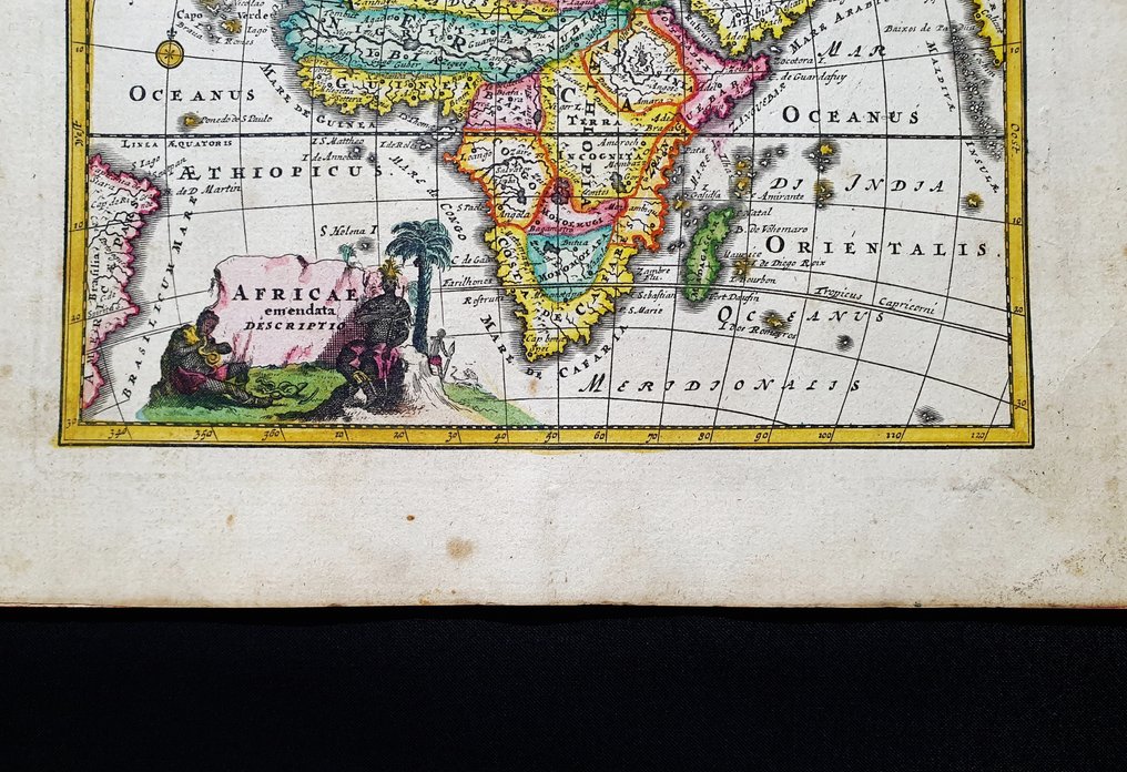
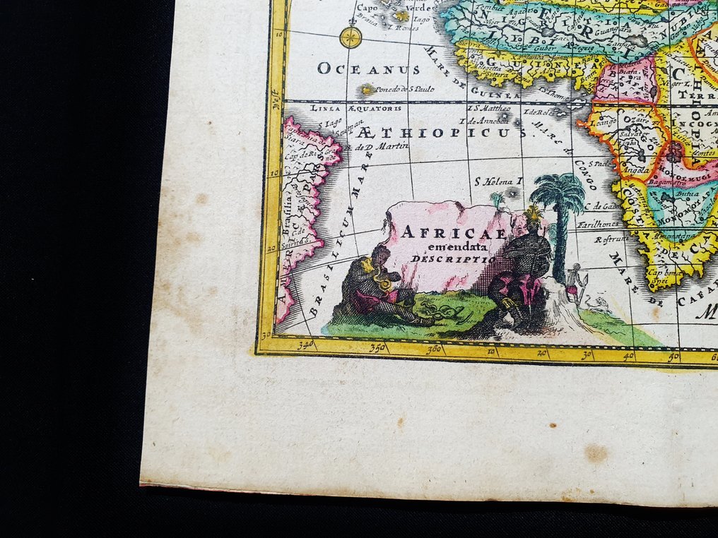
Africa - Madagascar / Congo / Guinea / Somalia / Senegal / Eritrea; Christopher Weigel & David Kohler - Africae Emendata Descriptio - 1701-1720

01
day
06
hours
20
minutes
36
seconds
Current bid
€ 38
No reserve price
14 other people are watching this object
nlBidder 2222 €38
itBidder 7905 €33
nlBidder 2222 €29

Catawiki Buyer Protection

Your payment’s safe with us until you receive your object.View details

Trustpilot 4.4 | 123951 reviews

Rated Excellent on Trustpilot.

Africae Emendata Descriptio, an original folio copper engraving from 1720 by Christopher Weigel & David Kohler, Latin edition of Descriptio Orbis Antiquii in XLIV Tabulis Exhibita, Germany, with hand colour and margins, detailing Madagascar, Congo, Guinea, Somalia, Senegal and Eritrea on a 24 by 18 cm map in very good condition with a barely visible rear reinforcement.

AI-assisted summary

Description from the seller

This geographical map is an original engraving on copper from 1720 (18th century).

This is the Latin edition of Weigel's work, edited by D. Kohler on ancient geography.
The map in question comes from the work titled: 'Descriptio Orbis Antiquii in 44 tables exhibited by IO. DAVIDE KOELERO... from Nuremberg, 1720.'

Large map in 4th size, printed in GERMANY, with excellent original coloring, wide margins, and geographically well detailed at every point.

Conditions: the conditions are very good as shown in the photo, with the presence of a reinforcement, completely invisible, located in the rear area.

The overall dimensions of the map are: 24 cm x 18 cm.

Seller's Story

I am a private Catawiki seller and I sell collectibles, a wonderful world.
Translated by Google Translate

Details

Era
1400-1900
Number of items
1
Country
Africa
Geographical specification
Madagascar / Congo / Guinea / Somalia / Senegal / Eritrea
Map maker/ publisher
Christopher Weigel & David Kohler
Map/ Book title
Africae Emendata Descriptio
Period
1701-1720
Condition
Excellent
Technique
Copper engraving
Additional Information
Original Folio copper engraving
Map colour
Contemporary hand colour
Height
24 cm
Width
18 cm
ItalyVerified
8472
Objects sold
100%
Privatetop

Similar objects

For you in

Maps