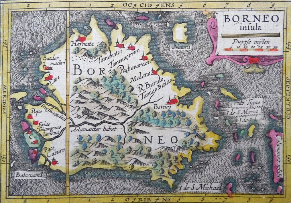
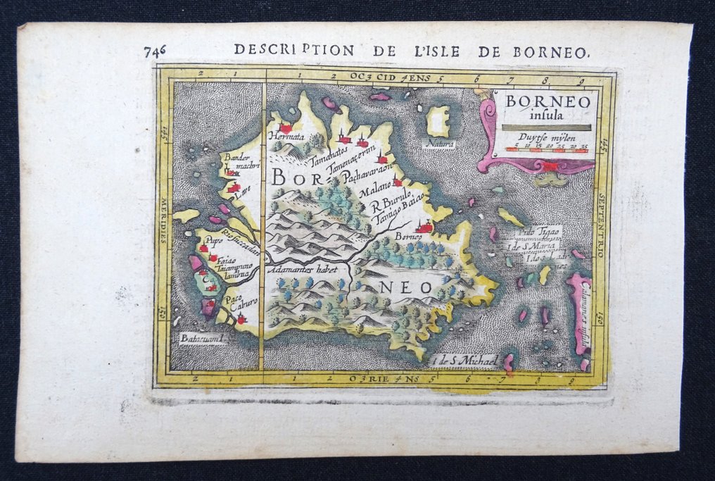
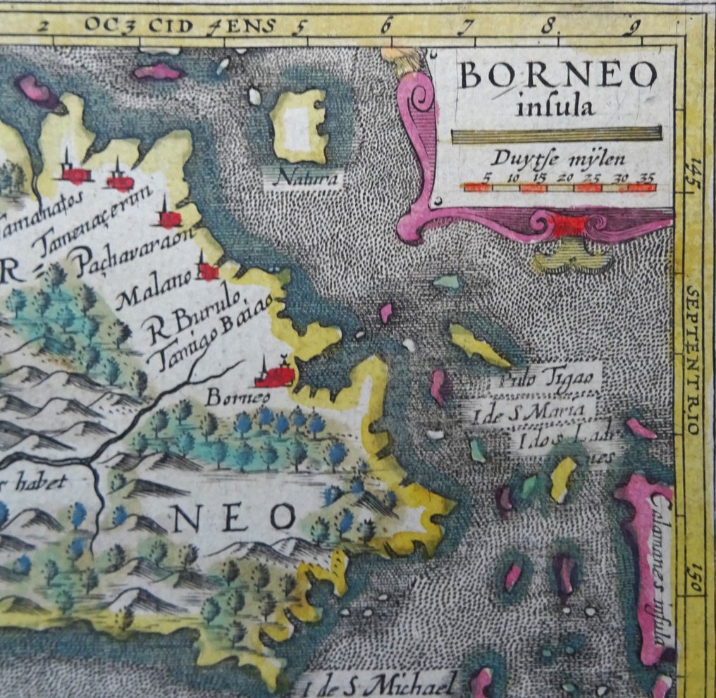
Indonesia - Malaysia, Brunei, Borneo, Kalimantan; Bertius / Hondius - Borneo Insula - 1601-1620

04
days
15
hours
33
minutes
25
seconds
Current bid
€ 15
No reserve price
Ilaria Colombo
Expert
Selected by Ilaria Colombo

Specialist in old books, specialising in theological disputes since 1999.

Estimate  € 150 - € 200
17 other people are watching this object
esBidder 1727 €15
nlBidder 4387 €10
esBidder 1727 €8

Catawiki Buyer Protection

Your payment’s safe with us until you receive your object.View details

Trustpilot 4.4 | 121798 reviews

Rated Excellent on Trustpilot.

This 1618 Borneo Insula by Petrus Bertius and Hondius is a copper engraving in excellent condition with original hand coloring, a compact view of Kalimantan’s coastlines and inland features.

AI-assisted summary

Description from the seller

Borneo Insula (1618)

Very beautiful map by Petrus Bertius of Borneo/Kalimantan. This miniature map of Borneo largely based on the map of Theodore de Bry. The map is oriented with north to the right with the hypothetical eastern coastline and place names primarily derived from Portuguese records. The interior is filled with mountains, forests, and a large river.

References: King (2nd ed.) pp. 96-99; Van der Krogt (Vol. III) #8540:342.


Original hand coloring (this was only done to a very limited number of these atlases).

Published by Hondius in Amsterdam in 1618 in a French edition of ´Géographie raccourcie par Pierre BERTIUS´.

Excellent condition. Original hand coloring (very rare, only a few copies were sold with hand coloring). Never folded. Reverse side text in French

Image 9,5x13,5cm, page 12,5x19cm

Details

Era
1400-1900
Number of items
1
Country
Indonesia
Geographical specification
Malaysia, Brunei, Borneo, Kalimantan
Map maker/ publisher
Bertius / Hondius
Map/ Book title
Borneo Insula
Period
1601-1620
Condition
Excellent
Technique
Copper engraving
Additional Information
Rare early 17th century map of the island of Borneo (Kalimantan), original coloring (rare!!)
Map colour
Contemporary hand colour
Height
9.5 cm
Width
13.5 cm
Sold by
SpainVerified
4682
Objects sold
100%
protop

Similar objects

For you in

Maps