Wereld; Europa; Azie; Afrika Rusland; Italie; Engeland; Frankrijk; Spanje; - World; Las Cases, Emmanuel Auguste Dieudonné Marius Joseph - 17 maps from the "Historisch-genealogisch-geographischer Atlas" by Las Cases - 1821-1850


06
days
20
hours
22
minutes
06
seconds

No bids placed
Catawiki Buyer Protection
Your payment’s safe with us until you receive your object.View details
Trustpilot 4.4 | 122813 reviews
Rated Excellent on Trustpilot.
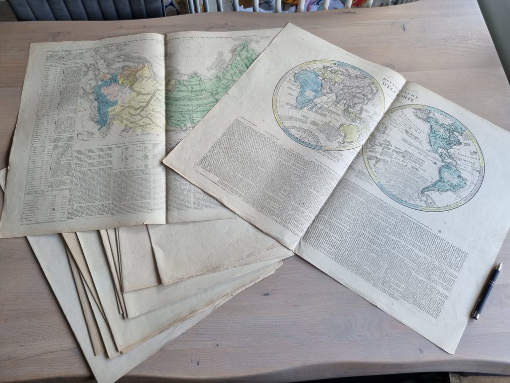
A set of 17 maps from the Historisch-genealogisch-geographischer Atlas by Las Cases, lithographed and printed in colour, produced by Velten in Karlsruhe (1825–1831), with sheets measuring 55 × 73 cm and designed by J. Velten.
AI-assisted summary
Description from the seller
9 Maps and 8 Tables from a German Historical Atlas. In addition to nine large and beautiful maps, it also contains a wealth of historical information. The maps are colored.
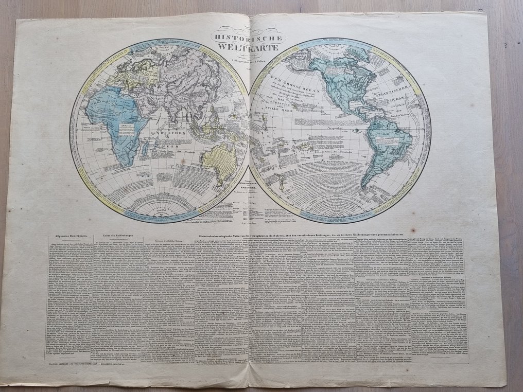
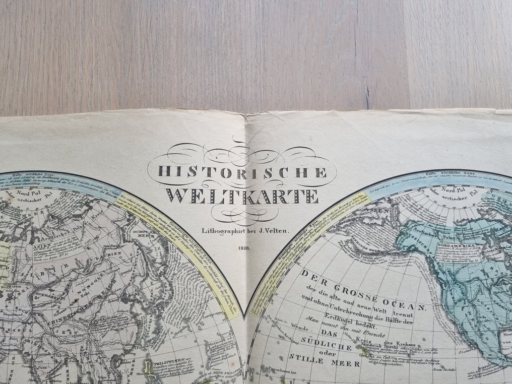
1. (Map) Historical world map lithographed by J. Velten. 1828.
Political balance of the imperial circle in the year 1828.
(Map) Geographical and statistical map of Russia in Europe and Asia, according to its graduated enlargements.
No. XXVII. Genealogy of the House of Holstein, ruling in Denmark, Russia, and Sweden.
5. (Map) No. XXXI. Geographical-historical table of Asia.
6. (map) No. XXX Europe Geographically, Politically, and Statistically from the year 1812.
Map No. XXXIV. Historical-Political Table of Modern Europe.
8. No. XXXVI. Old and new peoples and languages of Europe.
Map No. XIV. Historical-geographical map of England.
No. XIII. Genealogical-historical table of England.
(Map) No. XVIII. Geography of Spain and Portugal
No. XVII. Genealogical-Historical Table of the Kings of Portugal, Navarra, Castile, Aragon, and Spain.
Map No. XVI. Geographical and political map of Italy.
No. XV. Historical-genealogical table of the House of Savoy.
Map No. XXXII. Historical-geographical table of Africa.
Appendix to Table XIII.
Appendix to Table XIII.
Originating from the atlas.
Historical-genealogical-geographical Atlas: in thirty-three overviews / by Le Sage, Count Las Cases. From the French of the latest edition into German, translated with two political-geographical insights by Alexander von Dusch. Edited by Johann Velten. Karlsruhe: Velten, 1826 [published] 1825 – 1831
Some cards are slightly frayed along the edges, with a few spots here and there. Otherwise, they are in good condition. The attractive color cards were produced by Velten using a lithography process that was still new at the time.
Please do not make offers or respond on Sunday.
9 Maps and 8 Tables from a German Historical Atlas. In addition to nine large and beautiful maps, it also contains a wealth of historical information. The maps are colored.
1. (Map) Historical world map lithographed by J. Velten. 1828.
Political balance of the imperial circle in the year 1828.
(Map) Geographical and statistical map of Russia in Europe and Asia, according to its graduated enlargements.
No. XXVII. Genealogy of the House of Holstein, ruling in Denmark, Russia, and Sweden.
5. (Map) No. XXXI. Geographical-historical table of Asia.
6. (map) No. XXX Europe Geographically, Politically, and Statistically from the year 1812.
Map No. XXXIV. Historical-Political Table of Modern Europe.
8. No. XXXVI. Old and new peoples and languages of Europe.
Map No. XIV. Historical-geographical map of England.
No. XIII. Genealogical-historical table of England.
(Map) No. XVIII. Geography of Spain and Portugal
No. XVII. Genealogical-Historical Table of the Kings of Portugal, Navarra, Castile, Aragon, and Spain.
Map No. XVI. Geographical and political map of Italy.
No. XV. Historical-genealogical table of the House of Savoy.
Map No. XXXII. Historical-geographical table of Africa.
Appendix to Table XIII.
Appendix to Table XIII.
Originating from the atlas.
Historical-genealogical-geographical Atlas: in thirty-three overviews / by Le Sage, Count Las Cases. From the French of the latest edition into German, translated with two political-geographical insights by Alexander von Dusch. Edited by Johann Velten. Karlsruhe: Velten, 1826 [published] 1825 – 1831
Some cards are slightly frayed along the edges, with a few spots here and there. Otherwise, they are in good condition. The attractive color cards were produced by Velten using a lithography process that was still new at the time.
Please do not make offers or respond on Sunday.
Details
Era
1400-1900
Manufacturer/ Brand
Carlsruhe, Velten [1825-1831]
Number of items
17
Country
Wereld; Europa; Azie; Afrika Rusland; Italie; Engeland; Frankrijk; Spanje;
Geographical specification
World
Map maker/ publisher
Las Cases, Emmanuel Auguste Dieudonné Marius Joseph
Designer/Artist/Maker
J. Velten
Map/ Book title
17 maps from the "Historisch-genealogisch-geographischer Atlas" by Las Cases
Period
1821-1850
Condition
Reasonable
Technique
Lithography
Additional Information
Lithographic color printing was just new at that time.
Map colour
Printed in colour
Height
55 cm
Width
73 cm
Sold by
