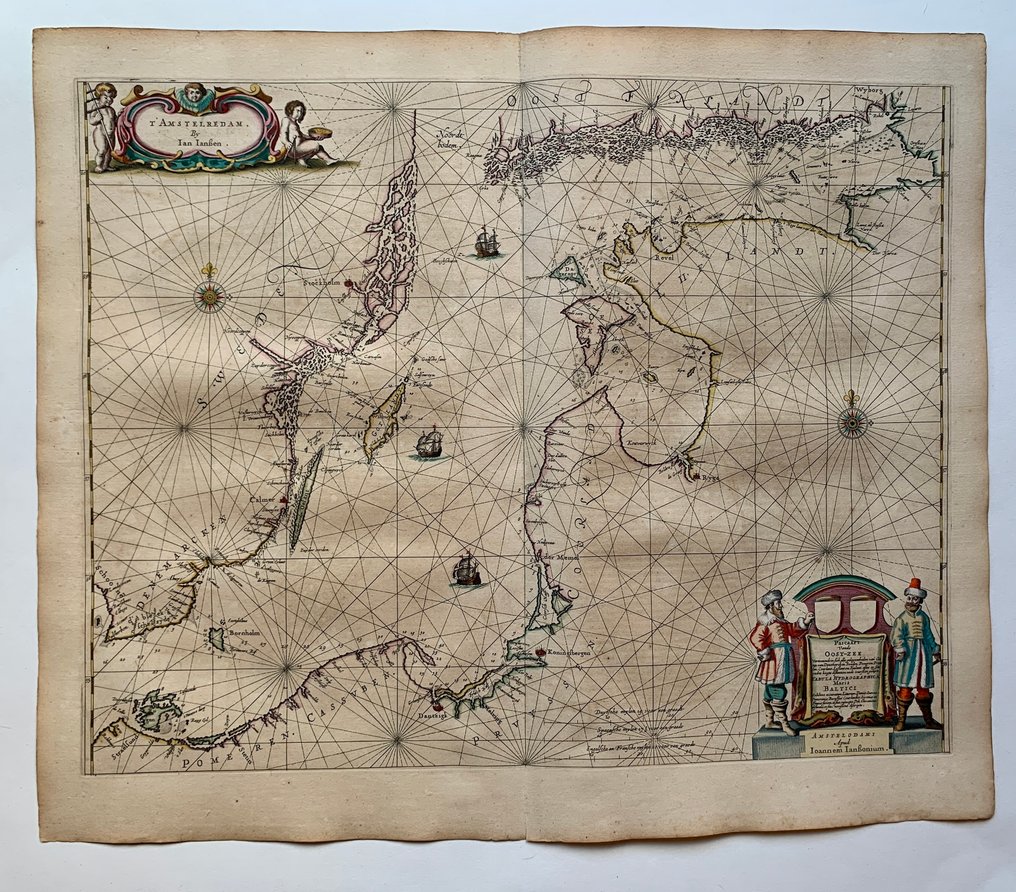
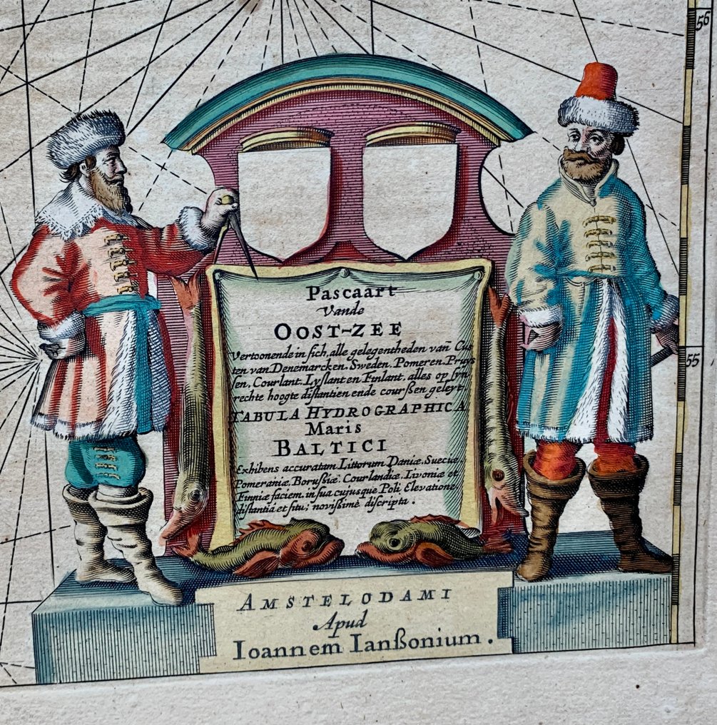
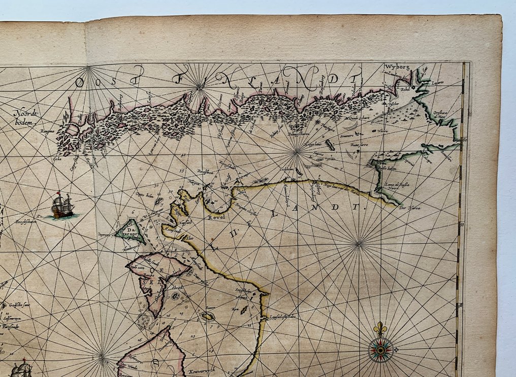
Baltic Sea - Eastern Europe; J. Janssonius - Pascaart vande Oost-Zee… Tabula Hydrographica Maris Baltici… Amstelodami apud Ioannem Ianssonium - 1621-1650

09
days
16
hours
28
minutes
06
seconds
Current bid
€ 265
Reserve price not met
Ilaria Colombo
Expert
Selected by Ilaria Colombo

Specialist in old books, specialising in theological disputes since 1999.

Estimate  € 1,000 - € 1,800
21 other people are watching this object
frBidder 9062 €265
frBidder 9062 €245
frBidder 9062 €225

Catawiki Buyer Protection

Your payment’s safe with us until you receive your object.View details

Trustpilot 4.4 | 121798 reviews

Rated Excellent on Trustpilot.

J. Janssonius’s copper-engraved sea chart Pascaart vande Oost-Zee… Tabula Hydrographica Maris Baltici… Amstelodami apud Ioannem Ianssonium, 1650, a rare Baltic Sea map in contemporary hand colour, covering the Baltic region of Northern Europe from the Skagerrak to the Gulf of Finland.

AI-assisted summary

Description from the seller

J. Janssonius, Pascaart vande Oost-Zee… Tabula Hydrographica Maris Baltici… Amstelodami apud Ioannem Ianssonium.

Rare, beautifully old colored sea chart of the Baltic Sea. The map covers the entire Baltic region, including Denmark, southern Sweden, Finland, Estonia, Latvia, Lithuania, Poland, and northern Germany, extending from the Skagerrak and Kattegat to the Gulf of Finland and Gulf of Bothnia.

Amsterdam, 1650.

Dimensions: 42,4 x 54,4 cm (engraving), 50 x 60 cm (paper).

Good condition, small tear in lower white middle fold.

Attention for US buyers: Due to recent postal restrictions shipping to the US can only be done by DHL, therefore higher shipping costs apply!

Details

Era
1400-1900
Number of items
1
Country
Baltic Sea
Geographical specification
Eastern Europe
Map maker/ publisher
J. Janssonius
Map/ Book title
Pascaart vande Oost-Zee… Tabula Hydrographica Maris Baltici… Amstelodami apud Ioannem Ianssonium
Period
1621-1650
Condition
Good
Technique
Copper engraving
Additional Information
Rare sea chart of the Baltic Region by J. Janssonius in original colour
Map colour
Contemporary hand colour
Height
50 cm
Width
60 cm
FranceVerified
1381
Objects sold
100%
protop

Similar objects

For you in

Maps