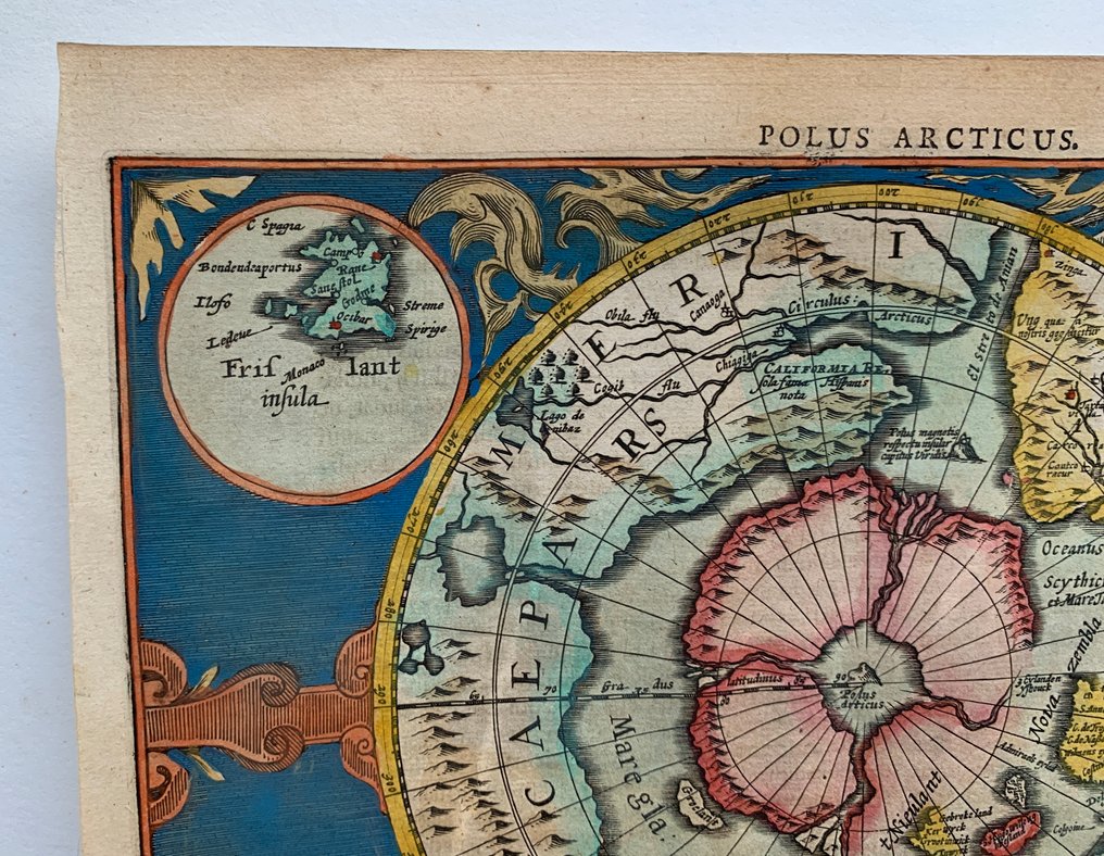
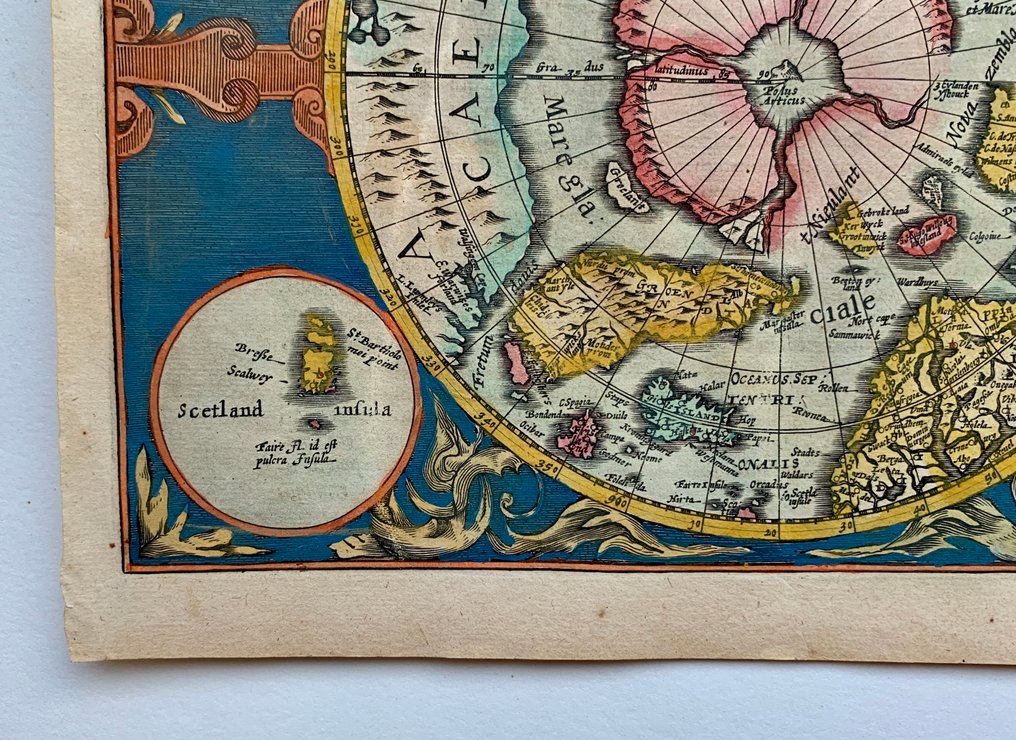
World - World; Gerard Mercator/ Jodocus Hondius/ Johannes Cloppenburgh - Polus Arcticus - 1621-1650

09
days
15
hours
03
minutes
02
seconds
Current bid
€ 330
Reserve price not met
Ilaria Colombo
Expert
Selected by Ilaria Colombo

Specialist in old books, specialising in theological disputes since 1999.

Estimate  € 600 - € 1,000
33 other people are watching this object
isBidder 2591 €330
frBidder 7631 €310
itBidder 0528 €290

Catawiki Buyer Protection

Your payment’s safe with us until you receive your object.View details

Trustpilot 4.4 | 121798 reviews

Rated Excellent on Trustpilot.

A highly decorative copper engraving of Polus Arcticus by Gerard Mercator with Jodocus Hondius and Johannes Cloppenburgh, an important early map of the North Polar Regions from 1632.

AI-assisted summary

Description from the seller

Gerard Mercator/ Jodocus Hondius/ Johannes Cloppenburgh, Polus Arcticus.

Amsterdam, 1632.

Highly decorative map of the North Pole of Cloppenburg's reduced size edition of Mercators' map, the first separate map of the North Polar Regions.

Dimensions: 18 x 24,5 cm (engraving), 21,5 x 27,8 cm (paper).

Very good condition.

Attention for US buyers: Due to recent postal restrictions shipping to the US can only be done by DHL, therefore higher shipping costs apply!

Details

Era
1400-1900
Number of items
1
Country
World
Geographical specification
World
Map maker/ publisher
Gerard Mercator/ Jodocus Hondius/ Johannes Cloppenburgh
Map/ Book title
Polus Arcticus
Period
1621-1650
Condition
Good
Technique
Copper engraving
Additional Information
Important map of the Polar Regions by Gerard Mercator/ Jodocus Hondius/ Johannes Cloppenburgh
Map colour
Later hand colour
Height
21.5 cm
Width
27.8 cm
FranceVerified
1381
Objects sold
100%
protop

Similar objects

For you in

Maps