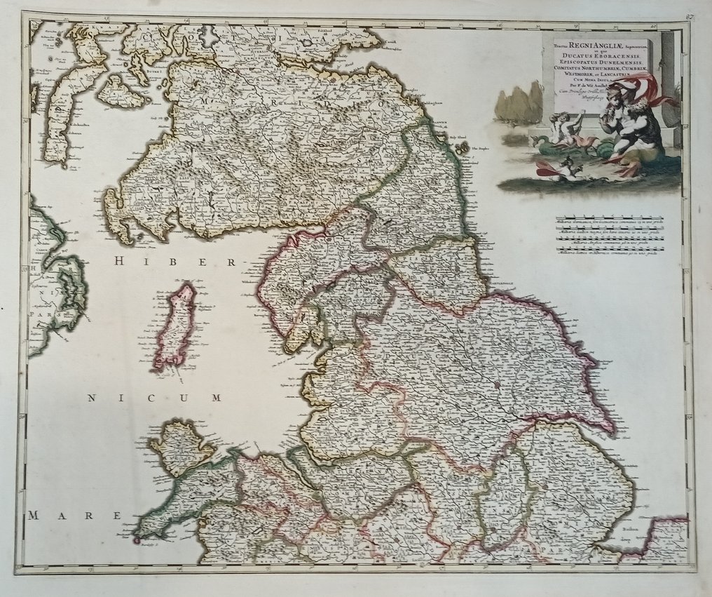
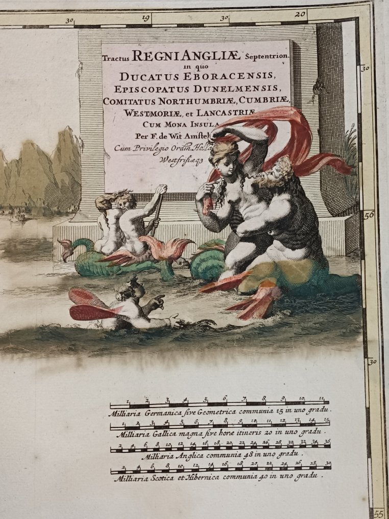
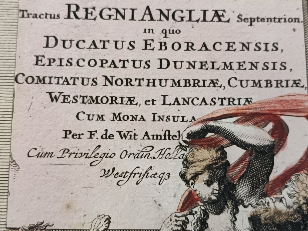
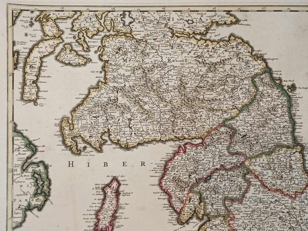
United Kingdom - North England; Frederik De Wit - Tractus Regni Angliae Septentrion in quo Ducatus Eboracensis, Episcopatus Dunelmensis, Comitatus - 1681-1700

04
days
21
hours
55
minutes
54
seconds
Starting bid
€ 1
No reserve price
No bids placed

Catawiki Buyer Protection

Your payment’s safe with us until you receive your object.View details

Trustpilot 4.4 | 122813 reviews

Rated Excellent on Trustpilot.

Antique copper‑engraved map of North England by Frederik De Wit, published by Pierre Mortier, from the De Wit Atlas, circa 1709, with contemporary hand colour and dimensions 63 × 53 cm.

AI-assisted summary

Description from the seller

Genuine antique map of North England by F. De Wit, published by Pierre Mortier.

Title: Tractus Regni Angliae Septentrion in quo Ducatus Eboracensis, Episcopatus Dunelmensis, Comitatus Northumbriae, CUmbriae, Westmoriae et Lancastriae.

Cartographer: F. De Wit.
Date of the first edition: c. 1691.
Date of this map: c. 1709.

Copper engraving, printed on paper.
Map size: 570 x 480mm (22.44 x 18.9 inches).
Sheet size: 63 x 53mm (Large margins!).
Verso: Blank.
Condition: Original coloured, excellent (See pictures)
Condition Rating: A

From: De Wit Atlas. Amsterdam, c. 1691-97.

Details

Era
1400-1900
Number of items
1
Country
United Kingdom
Geographical specification
North England
Map maker/ publisher
Frederik De Wit
Designer/Artist/Maker
Frederik De Witt
Map/ Book title
Tractus Regni Angliae Septentrion in quo Ducatus Eboracensis, Episcopatus Dunelmensis, Comitatus
Period
1681-1700
Condition
Excellent
Technique
Copper engraving
Additional Information
-
Map colour
Contemporary hand colour
Height
63 cm
Width
53 cm
BelgiumVerified
226
Objects sold
100%
Private

Similar objects

For you in

Maps