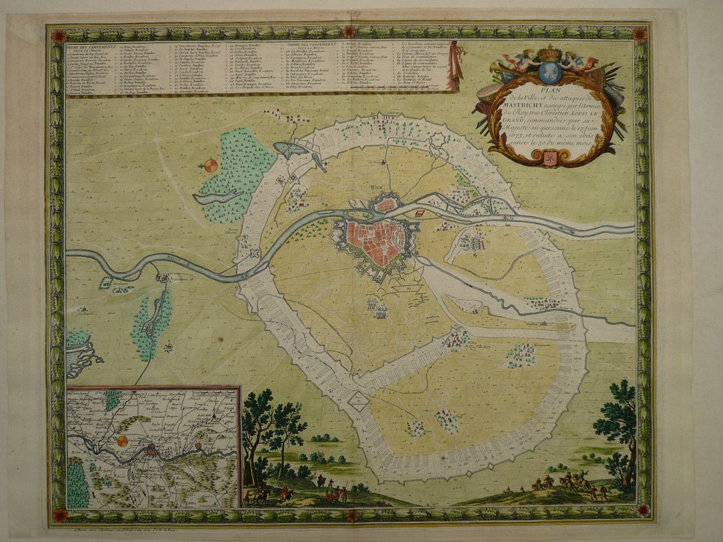
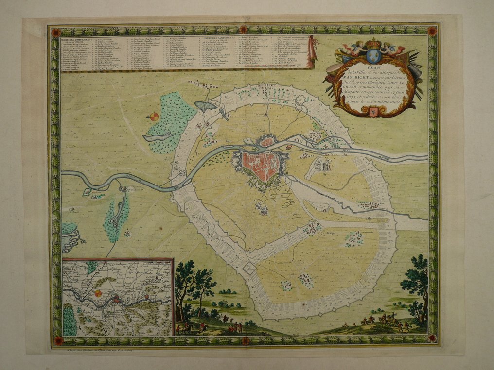
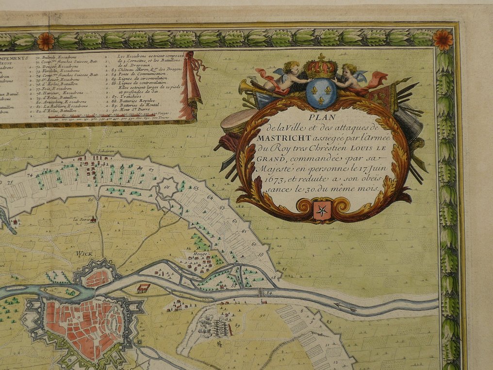
Europe - The Netherlands / Maastricht; Bernard-Antoine Jaillot - Plan de la ville et des attaques de Mastricht (...) - 1681-1700

01
day
15
hours
33
minutes
51
seconds
Current bid
€ 200
Reserve price not met
Ilaria Colombo
Expert
Selected by Ilaria Colombo

Specialist in old books, specialising in theological disputes since 1999.

Estimate  € 1,600 - € 2,000
27 other people are watching this object
nlBidder 9585 €200
nlBidder 7407 €32
nlBidder 7407 €27

Catawiki Buyer Protection

Your payment’s safe with us until you receive your object.View details

Trustpilot 4.4 | 121798 reviews

Rated Excellent on Trustpilot.

A copper engraved plan of Maastricht by Bernard-Antoine Jaillot, circa 1681–1700, with a contemporary hand colour and an inset map, offering a highly detailed view of the city and its surroundings.

AI-assisted summary

Description from the seller

45 x 54 cm.
Copperengraving published as a broad sheet by Bernard-Antoine Jaillot. Paris ca. 1675
Sometimes found in an Atlas by J. Jaillot.

Insured shipping

45 x 54 cm.
Copperengraving published as a broad sheet by Bernard-Antoine Jaillot. Paris ca. 1675
Sometimes found in an Atlas by J. Jaillot.

Insured shipping

Details

Era
1400-1900
Country
Europe
Geographical specification
The Netherlands / Maastricht
Map maker/ publisher
Bernard-Antoine Jaillot
Map/ Book title
Plan de la ville et des attaques de Mastricht (...)
Period
1681-1700
Condition
Excellent
Technique
Copper engraving
Additional Information
very rare 18th century plan of the city with inset map of the environments
Map colour
Contemporary hand colour
Height
45 cm
Width
54 cm
Sold by
The NetherlandsVerified
24828
Objects sold
100%
protop

Similar objects

For you in

Maps