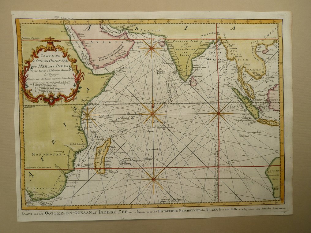
South America - Indian ocean / Madagascar / Australia / Sumatra; Nicolas Bellin - Carte de l'Ocean Oriental ou Mer des Indes - 1721-1750

04
days
15
hours
26
minutes
54
seconds
Current bid
€ 8
No reserve price
Ilaria Colombo
Expert
Selected by Ilaria Colombo

Specialist in old books, specialising in theological disputes since 1999.

Estimate  € 150 - € 200
22 other people are watching this object
nlBidder 4093 €8
nlBidder 6939 €7
nlBidder 7090 €6

Catawiki Buyer Protection

Your payment’s safe with us until you receive your object.View details

Trustpilot 4.4 | 121798 reviews

Rated Excellent on Trustpilot.

Carte de l'Ocean Oriental ou Mer des Indes by Nicolas Bellin, Paris 1747, copper engraving with contemporary hand colour, 35 x 48 cm, 18th century map of the Indian Ocean covering Madagascar, Australia, Sumatra, with a rare Dutch edition, Country: South America.

AI-assisted summary

Description from the seller

35 x 48 cm.
Copperengraving published in: "Histoire generale des Voyages ou nouvelle collection de toutes les relations de voyages par mer et par terre". Nicolas Bellin. Paris 1747.
Folds as published.

Insured shipping.

35 x 48 cm.
Copperengraving published in: "Histoire generale des Voyages ou nouvelle collection de toutes les relations de voyages par mer et par terre". Nicolas Bellin. Paris 1747.
Folds as published.

Insured shipping.

Details

Era
1400-1900
Country
South America
Geographical specification
Indian ocean / Madagascar / Australia / Sumatra
Map maker/ publisher
Nicolas Bellin
Map/ Book title
Carte de l'Ocean Oriental ou Mer des Indes
Period
1721-1750
Condition
Excellent
Technique
Copper engraving
Additional Information
18th century map of th Indian Ocean. Rare Dutch edition.
Map colour
Contemporary hand colour
Height
35 cm
Width
48 cm
Sold by
The NetherlandsVerified
24828
Objects sold
100%
protop

Similar objects

For you in

Maps